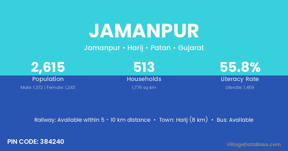
Jamanpur village is located in the Harij Taluka of the Patan district in Gujarat .
Block / Taluka → Harij
District → Patan
State → Gujarat
According to Census 2011 information, the village code of Jamanpur village is 384240.
Jamanpur village has a total population of 2,615 people, of which 1,372 are males and 1,243 are females.
The literacy rate of Jamanpur village is 55.79%. Male literacy stands at 65.16% and female literacy at 45.45%.
There are approximately 513 households in Jamanpur village.
Harij (8 km) is the nearest town to Jamanpur village for major economic activities and is located approximately 8 km away.
The population of Jamanpur village is distributed between literate and illiterate residents as follows:
| Particulars | Male | Female | Total |
|---|---|---|---|
| Literate | 894 | 565 | 1,459 |
| Illiterate | 478 | 678 | 1,156 |
| Total | 1,372 | 1,243 | 2,615 |
Source: Census 2011
| Village | District |
|---|---|
| Adiya | Patan |
| Dantarvada | Patan |
| Govna | Patan |
| Jaska | Ahmadabad |
| Jaska | Mahesana |
| Jaska | Patan |
| Jasomav | Patan |
| Kalana | Ahmadabad |
| Kalana | Patan |
| Kalana | Rajkot |
| Kalana | Jajapur |
| Kalana | Churu |
| Kalana | Allahabad |
| Kalana | Banda |
| Kalana | Fatehpur |
| Kureja | Patan |
| Piluvada | Patan |
| Sodhav | Patan |
| Tamboliya | Patan |
| Tamboliya | Vadodara |
| Tamboliya | Mandsaur |
| Tamboliya | Ratlam |
| Tamboliya | Ratlam |
| Tamboliya | Chittaurgarh |
| Tamboliya | Dungarpur |
| Tamboliya | Dungarpur |
| Tornipur | Patan |
No reviews yet. Be the first to review this village!
Available within 5 - 10 km distance
Available within village
Available within 5 - 10 km distance