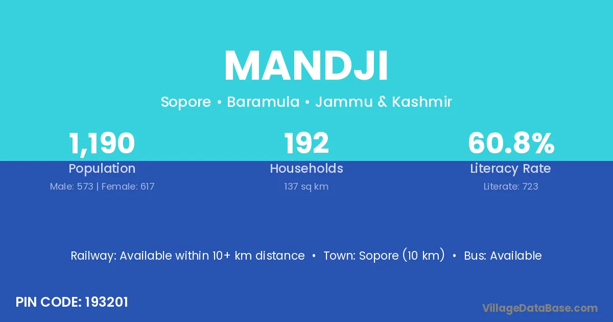
Mandji village is located in the Sopore Tehsil of the Baramula district in Jammu & Kashmir .
Block / Tehsil → Sopore
District → Baramula
State → Jammu & Kashmir
According to Census 2011 information, the village code of Mandji village is 193201.
Mandji village has a total population of 1,190 people, of which 573 are males and 617 are females.
The literacy rate of Mandji village is 60.76%. Male literacy stands at 68.24% and female literacy at 53.81%.
There are approximately 192 households in Mandji village.
Sopore (10 km) is the nearest town to Mandji village for major economic activities and is located approximately 10 km away.
The population of Mandji village is distributed between literate and illiterate residents as follows:
| Particulars | Male | Female | Total |
|---|---|---|---|
| Literate | 391 | 332 | 723 |
| Illiterate | 182 | 285 | 467 |
| Total | 573 | 617 | 1,190 |
Source: Census 2011
| Village | District |
|---|---|
| Botingu | Baramula |
| Bumai | Baramula |
| Doru | Badgam |
| Doru | Badgam |
| Doru | Baramula |
| Gori Pora Dara Pora | Baramula |
| Hasmat Pora | Baramula |
| Magri Pora | Anantnag |
| Magri Pora | Baramula |
| Mala Mapan Pora | Baramula |
| Muqam Shaheed Mir | Baramula |
| Sem Pora | Baramula |
| Wadura | Baramula |
| Wadura | Amravati |
| Wadura | Amravati |
| Wadura | Amravati |
| Wadura | Amravati |
| Wadura | Amravati |
| Wadura | Amravati |
| Watlab | Baramula |
No reviews yet. Be the first to review this village!
Available within 10+ km distance
Available within 5 - 10 km distance
Available within village