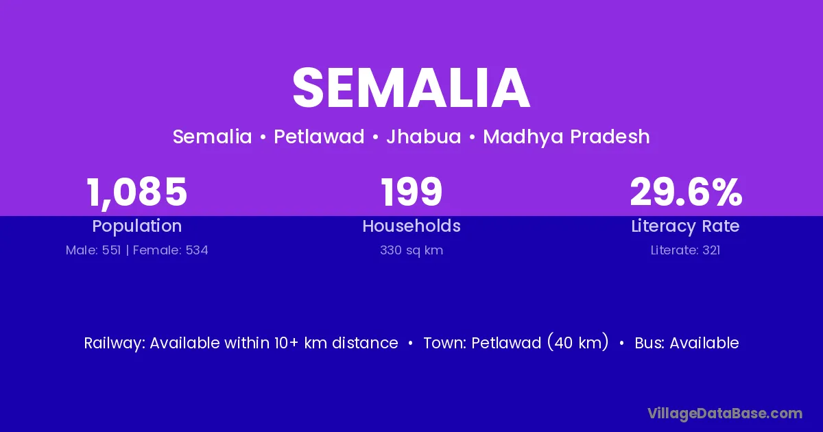
Semalia village is located in the Petlawad Tehsil of the Jhabua district in Madhya Pradesh .
Block / Tehsil → Petlawad
District → Jhabua
State → Madhya Pradesh
Semalia village has a total population of 1,085 people, of which 551 are males and 534 are females.
The literacy rate of Semalia village is 29.59%. Male literacy stands at 40.11% and female literacy at 18.73%.
There are approximately 199 households in Semalia village.
Petlawad (40 km) is the nearest town to Semalia village for major economic activities and is located approximately 40 km away.
The population of Semalia village is distributed between literate and illiterate residents as follows:
| Particulars | Male | Female | Total |
|---|---|---|---|
| Literate | 221 | 100 | 321 |
| Illiterate | 330 | 434 | 764 |
| Total | 551 | 534 | 1,085 |
Source: Census 2011
| Village | District |
|---|---|
| Bawadi | Bastar |
| Bawadi | Narayanpur |
| Bawadi | Jhabua |
| Bawadi | Jhabua |
| Bawadi | Morena |
| Bawadi | Morena |
| Bawadi | Ratlam |
| Charel | Rajkot |
| Charel | Jhabua |
| Charel | Kota |
| Dhebar | Siwan |
| Dhebar | Jamnagar |
| Dhebar | Junagadh |
| Dhebar | Jhabua |
| Dhebar | Jhabua |
| Jhaknawada | Jhabua |
| Juwanpura | Jhabua |
| Kalikarai | Jhabua |
| Nadatod | Dohad |
| Nadatod | Jhabua |
| Petlawad | Dhar |
| Petlawad | Jhabua |
| Petlawad | Ujjain |
| Piplipada | Jhabua |
| Piplipada | Jhabua |
| Piplipada | Ratlam |
| Piplipada | Ratlam |
| Sukhneda | Jhabua |
| Todi | Bhavnagar |
| Todi | Bhiwani |
| Todi | Guna |
| Todi | Guna |
| Todi | Indore |
| Todi | Jhabua |
| Todi | Jhabua |
| Todi | Rajgarh |
| Todi | Sheopur |
| Todi | Tikamgarh |
| Todi | Alwar |
| Todi | Banswara |
| Todi | Bhilwara |
| Todi | Jaipur |
| Todi | Jhunjhunun |
| Todi | Udaipur |
| Todi | Jhansi |
| Todi | Lalitpur |
No reviews yet. Be the first to review this village!
Available within 10+ km distance
Available within 5 - 10 km distance
Available within 5 - 10 km distance