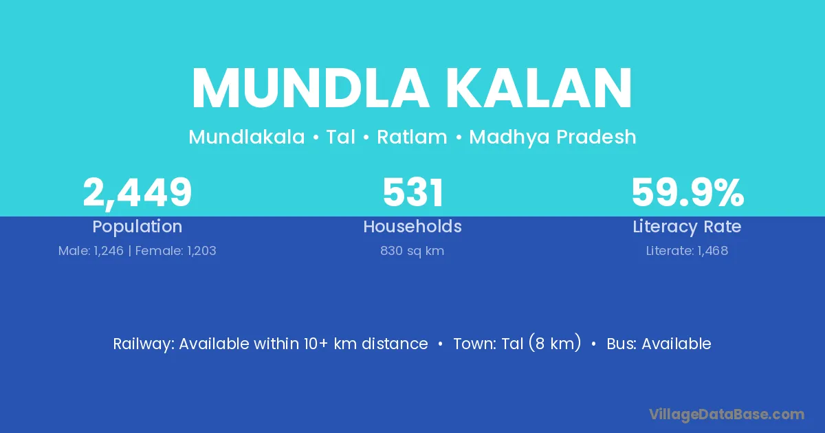
Mundla Kalan village is located in the Tal Tehsil of the Ratlam district in Madhya Pradesh .
Block / Tehsil → Tal
District → Ratlam
State → Madhya Pradesh
Mundla Kalan village has a total population of 2,449 people, of which 1,246 are males and 1,203 are females.
The literacy rate of Mundla Kalan village is 59.94%. Male literacy stands at 73.03% and female literacy at 46.38%.
There are approximately 531 households in Mundla Kalan village.
Tal (8 km) is the nearest town to Mundla Kalan village for major economic activities and is located approximately 8 km away.
The population of Mundla Kalan village is distributed between literate and illiterate residents as follows:
| Particulars | Male | Female | Total |
|---|---|---|---|
| Literate | 910 | 558 | 1,468 |
| Illiterate | 336 | 645 | 981 |
| Total | 1,246 | 1,203 | 2,449 |
Source: Census 2011
| Village | District |
|---|---|
| Ankya Kalan | Ratlam |
| Bhaisana | Guna |
| Bhaisana | Rajgarh |
| Bhaisana | Ratlam |
| Bhaisana | Ratlam |
| Bhaisana | Shivpuri |
| Bhaisana | Pali |
| Bhaisana | Pratapgarh |
| Bisal Kheda | Ratlam |
| Charan Khedi | Ratlam |
| Dhatrawada | Ratlam |
| Dhatrawada | Ratlam |
| Dhatrawada | Shajapur |
| Dhatrawada | Ujjain |
| Dhatrawada | Jhalawar |
| Gaddu Khedi | Ratlam |
| Hampura | Ratlam |
| Hampura | Bhilwara |
| Kher Jamuniya | Ratlam |
| Kothadi | Junagadh |
| Kothadi | Alirajpur |
| Kothadi | Dewas |
| Kothadi | Mandsaur |
| Kothadi | Ratlam |
| Kothadi | Shajapur |
| Kothadi | Shajapur |
| Melu Khedi | Ratlam |
| Nakatwada | Ratlam |
No reviews yet. Be the first to review this village!
Available within 10+ km distance
Available within <5 km distance
Available within <5 km distance