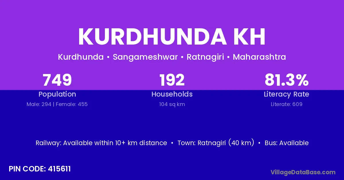
Kurdhunda Kh village is located in the Sangameshwar Tehsil of the Ratnagiri district in Maharashtra .
Block / Tehsil → Sangameshwar
District → Ratnagiri
State → Maharashtra
According to Census 2011 information, the village code of Kurdhunda Kh village is 415611.
Kurdhunda Kh village has a total population of 749 people, of which 294 are males and 455 are females.
The literacy rate of Kurdhunda Kh village is 81.31%. Male literacy stands at 87.41% and female literacy at 77.36%.
There are approximately 192 households in Kurdhunda Kh village.
Ratnagiri (40 km) is the nearest town to Kurdhunda Kh village for major economic activities and is located approximately 40 km away.
The population of Kurdhunda Kh village is distributed between literate and illiterate residents as follows:
| Particulars | Male | Female | Total |
|---|---|---|---|
| Literate | 257 | 352 | 609 |
| Illiterate | 37 | 103 | 140 |
| Total | 294 | 455 | 749 |
Source: Census 2011
| Village | District |
|---|---|
| Davkhol | Ratnagiri |
| Dingni Kuran | Ratnagiri |
| Kondye | Ratnagiri |
| Kondye | Ratnagiri |
| Kondye | Sindhudurg |
| Kurdhunda | Ratnagiri |
| Lovale | Ratnagiri |
| Mabhale | Ratnagiri |
| Navdi | Ratnagiri |
| Nidhalewadi | Ratnagiri |
| Phungus | Ratnagiri |
| Pochari | Dhanbad |
| Pochari | Ratnagiri |
| Upale | Ratnagiri |
| Upale | Ratnagiri |
| Upale | Ratnagiri |
| Upale | Sindhudurg |
| Upale | Solapur |
No reviews yet. Be the first to review this village!
Available within 10+ km distance
Available within village
Available within 5 - 10 km distance