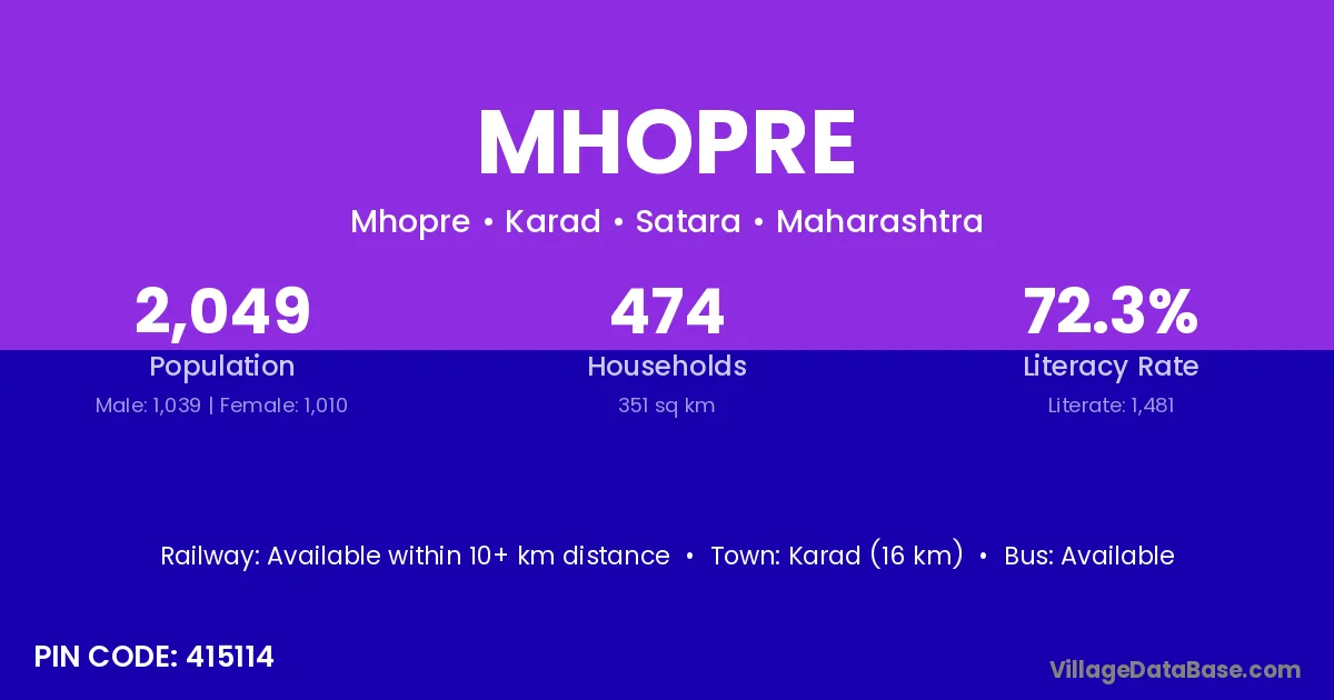
Mhopre village is located in the Karad Tehsil of the Satara district in Maharashtra .
Block / Tehsil → Karad
District → Satara
State → Maharashtra
According to Census 2011 information, the village code of Mhopre village is 415114.
Mhopre village has a total population of 2,049 people, of which 1,039 are males and 1,010 are females.
The literacy rate of Mhopre village is 72.28%. Male literacy stands at 77.48% and female literacy at 66.93%.
There are approximately 474 households in Mhopre village.
Karad (16 km) is the nearest town to Mhopre village for major economic activities and is located approximately 16 km away.
The population of Mhopre village is distributed between literate and illiterate residents as follows:
| Particulars | Male | Female | Total |
|---|---|---|---|
| Literate | 805 | 676 | 1,481 |
| Illiterate | 234 | 334 | 568 |
| Total | 1,039 | 1,010 | 2,049 |
Source: Census 2011
| Village | District |
|---|---|
| Abachiwadi | Satara |
| Beldari | Buldana |
| Beldari | Satara |
| Beldari | Yavatmal |
| Bholewadi | Ahmadnagar |
| Bholewadi | Ratnagiri |
| Bholewadi | Satara |
| Gote | Lower Subansiri |
| Gote | Satara |
| Govare | Satara |
| Govare | Satara |
| Kese | Satara |
| Kese | Bankura |
| Kese | Birbhum |
| Padalikese | Satara |
| Pashchimsupane | Satara |
| Varunji | Satara |
| Vasantgad | Satara |
| Vastisakurdi | Satara |
No reviews yet. Be the first to review this village!
Available within 10+ km distance
Available within village
Available within 10+ km distance