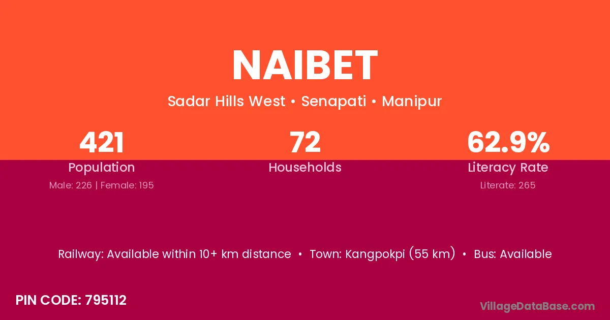
Naibet village is located in the Sadar Hills West Subdivision of the Senapati district in Manipur .
Block / Subdivision → Sadar Hills West
District → Senapati
State → Manipur
According to Census 2011 information, the village code of Naibet village is 795112.
Naibet village has a total population of 421 people, of which 226 are males and 195 are females.
The literacy rate of Naibet village is 62.95%. Male literacy stands at 73.01% and female literacy at 51.28%.
There are approximately 72 households in Naibet village.
Kangpokpi (55 km) is the nearest town to Naibet village for major economic activities and is located approximately 55 km away.
The population of Naibet village is distributed between literate and illiterate residents as follows:
| Particulars | Male | Female | Total |
|---|---|---|---|
| Literate | 165 | 100 | 265 |
| Illiterate | 61 | 95 | 156 |
| Total | 226 | 195 | 421 |
Source: Census 2011
| Village | District |
|---|---|
| Chalwa | Senapati |
| Chalwa | Udaipur |
| Dahalthari | Senapati |
| Gelbung | Senapati |
| Gorkha Harup | Senapati |
| Govajang | Chandel |
| Govajang | Churachandpur |
| Govajang | Senapati |
| Govajang | Senapati |
| Harup Kuki | Senapati |
| Joupi | Chandel |
| Joupi | Senapati |
| Joupi | Senapati |
| Makui Mayangkhang | Senapati |
| Santing | Churachandpur |
| Santing | Senapati |
| Santing | Senapati |
| T Waichong | Senapati |
| Timsina | Senapati |
No reviews yet. Be the first to review this village!
Available within 10+ km distance
Available within 10+ km distance
Available within 5 - 10 km distance