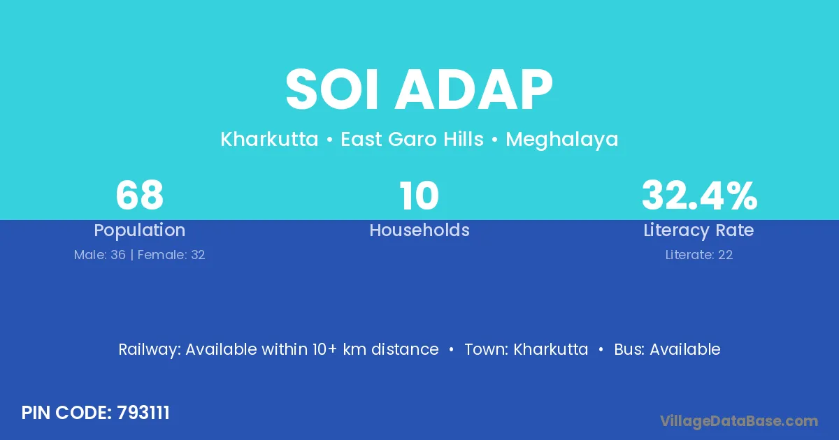
Soi Adap village is located in the Kharkutta Subdivision of the East Garo Hills district in Meghalaya .
Block / Subdivision → Kharkutta
District → East Garo Hills
State → Meghalaya
According to Census 2011 information, the village code of Soi Adap village is 793111.
Soi Adap village has a total population of 68 people, of which 36 are males and 32 are females.
The literacy rate of Soi Adap village is 32.35%. Male literacy stands at 33.33% and female literacy at 31.25%.
There are approximately 10 households in Soi Adap village.
Kharkutta is the nearest town to Soi Adap village for major economic activities
The population of Soi Adap village is distributed between literate and illiterate residents as follows:
| Particulars | Male | Female | Total |
|---|---|---|---|
| Literate | 12 | 10 | 22 |
| Illiterate | 24 | 22 | 46 |
| Total | 36 | 32 | 68 |
Source: Census 2011
| Village | District |
|---|---|
| Agropatal | East Garo Hills |
| Gabil Ading | East Garo Hills |
| Gabil Ading | East Garo Hills |
| Illagittim Rongchim | East Garo Hills |
| Illagittim Songma | East Garo Hills |
| Jongkigittim | East Garo Hills |
| Mandadrop | East Garo Hills |
| Mandu | Hamirpur |
| Mandu | Kangra |
| Mandu | Ramgarh |
| Mandu | Amravati |
| Mandu | Tamenglong |
| Mandu | East Garo Hills |
| Matchagipok | East Garo Hills |
| Nongbak Wapil | East Garo Hills |
| Petchong | East Garo Hills |
| Rongchri | East Garo Hills |
No reviews yet. Be the first to review this village!
Available within 10+ km distance
Available within 10+ km distance
Available within 10+ km distance