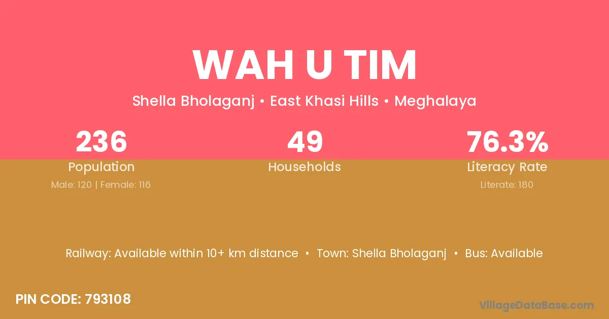
Wah U Tim village is located in the Shella Bholaganj Subdivision of the East Khasi Hills district in Meghalaya .
Block / Subdivision → Shella Bholaganj
District → East Khasi Hills
State → Meghalaya
According to Census 2011 information, the village code of Wah U Tim village is 793108.
Wah U Tim village has a total population of 236 people, of which 120 are males and 116 are females.
The literacy rate of Wah U Tim village is 76.27%. Male literacy stands at 75.83% and female literacy at 76.72%.
There are approximately 49 households in Wah U Tim village.
Shella Bholaganj is the nearest town to Wah U Tim village for major economic activities
The population of Wah U Tim village is distributed between literate and illiterate residents as follows:
| Particulars | Male | Female | Total |
|---|---|---|---|
| Literate | 91 | 89 | 180 |
| Illiterate | 29 | 27 | 56 |
| Total | 120 | 116 | 236 |
Source: Census 2011
| Village | District |
|---|---|
| Lumrynjang | East Khasi Hills |
| Mawblang | East Khasi Hills |
| Mawblang | East Khasi Hills |
| Mawblang | Ribhoi |
| Mawlatang | East Khasi Hills |
| Mawshamok | East Khasi Hills |
| Mawshar | East Khasi Hills |
| Mawsmai | East Khasi Hills |
| Mawsmai | Ribhoi |
| Mawsmai | West Khasi Hills |
| Mawsmai | West Khasi Hills |
| Nongkroh | East Khasi Hills |
| Nongkroh | East Khasi Hills |
| Nongla | East Khasi Hills |
| Nongthynmmai | East Khasi Hills |
| Tyrna | East Khasi Hills |
| Tyrngei | East Khasi Hills |
No reviews yet. Be the first to review this village!
Available within 10+ km distance
Available within 5 - 10 km distance
Available within 5 - 10 km distance