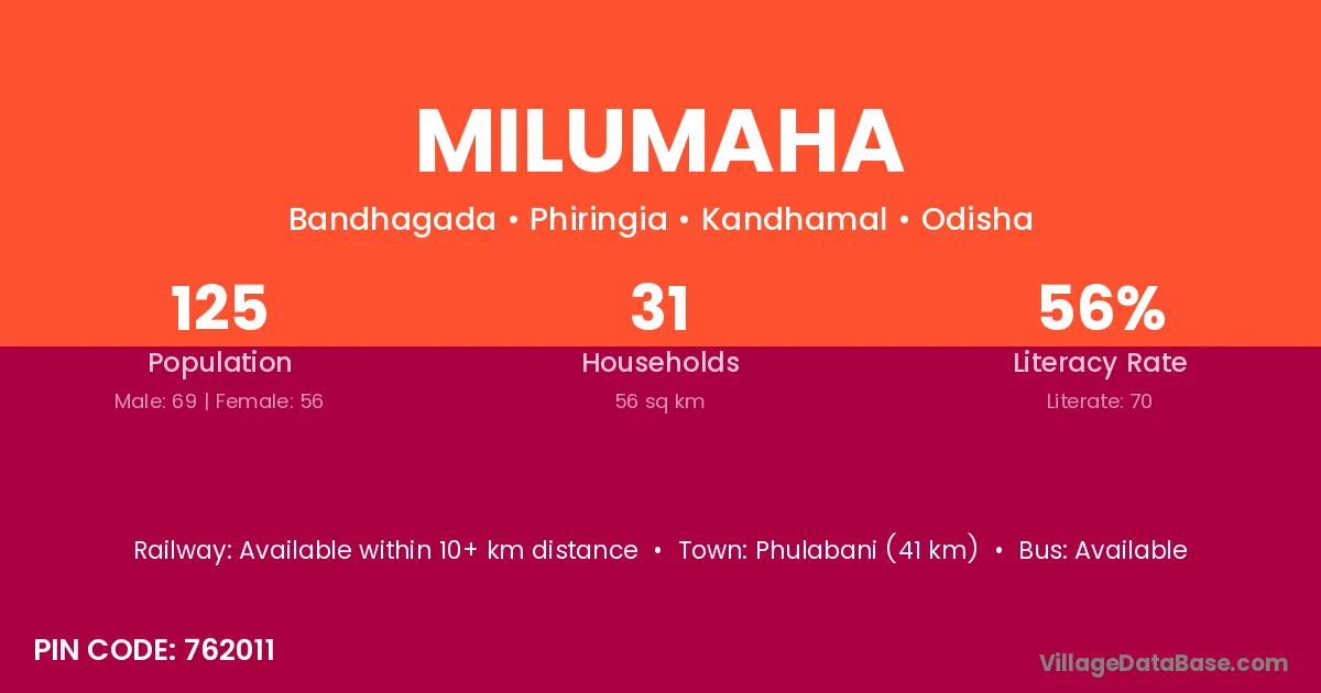
Milumaha village is located in the Phiringia Tehsil of the Kandhamal district in Odisha .
Block / Tehsil → Phiringia
District → Kandhamal
State → Odisha
According to Census 2011 information, the village code of Milumaha village is 762011.
Milumaha village has a total population of 125 people, of which 69 are males and 56 are females.
The literacy rate of Milumaha village is 56.00%. Male literacy stands at 63.77% and female literacy at 46.43%.
There are approximately 31 households in Milumaha village.
Phulabani (41 km) is the nearest town to Milumaha village for major economic activities and is located approximately 41 km away.
The population of Milumaha village is distributed between literate and illiterate residents as follows:
| Particulars | Male | Female | Total |
|---|---|---|---|
| Literate | 44 | 26 | 70 |
| Illiterate | 25 | 30 | 55 |
| Total | 69 | 56 | 125 |
Source: Census 2011
| Village | District |
|---|---|
| Bakapali | Baudh |
| Bakapali | Kandhamal |
| Ghatipadar | Kandhamal |
| Jagarpadar | Kandhamal |
| Jamupakal | Kandhamal |
| Jarakapada | Kandhamal |
| Lamapadar | Kandhamal |
| Lengarana | Kandhamal |
| Porapara | West Garo Hills |
| Porapara | Baleshwar |
| Porapara | Bhadrak |
| Porapara | Kandhamal |
| Porapara | Paschim Medinipur |
| Porapara | Paschim Medinipur |
| Ratanga | Bhadrak |
| Ratanga | Gajapati |
| Ratanga | Kandhamal |
| Ratanga | Nagaur |
| Singabadi | Ganjam |
| Singabadi | Kandhamal |
| Tabinipadar | Kandhamal |
No reviews yet. Be the first to review this village!
Available within 10+ km distance
Available within <5 km distance
Available within <5 km distance