Mahulapada: A Town and Tehsil in Sundargarh district
District → Sundargarh
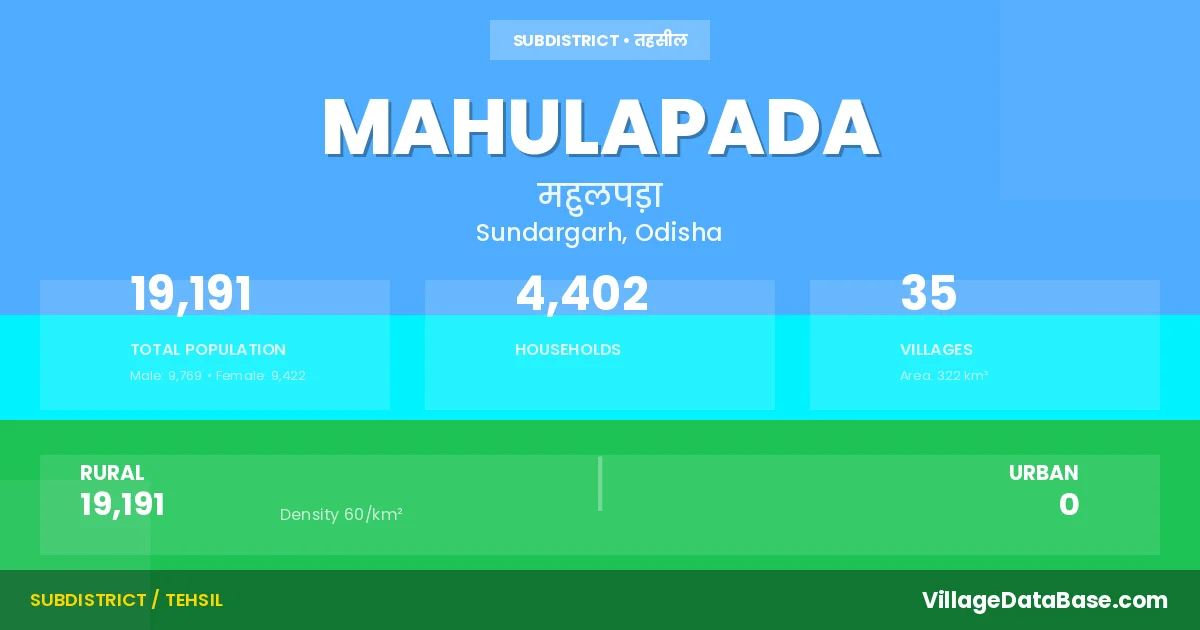
State → Odisha
Mahulapada is a town and Tehsil in the Sundargarh district of the Odisha. In India, a Tehsil is a subdivision of a district responsible for the administration and revenue collection of a specific area within the district. Tehsils play a crucial role in the local governance structure, contributing significantly to the development and administration of their communities.
According to the 2011 census The total area of Mahulapada Tehsil is 322 km², with a population of 19191 people. The population density is 60 inhabitants per square kilometre, and there are approximately 4402 houses in the sub district.
Mahulapada Tehsil comprises about 35 villages. Below is a list of these villages along with information about their respective gram panchayats and the nearest town:
| # | Village Name | Gram Panchayat | Nearest Town |
|---|---|---|---|
| 1 | Angul | Haldikudar | Raurkela (47 km) |
| 2 | Badachuan | Daleisara | Raurkela (112 km) |
| 3 | Badjala | Fuljhar | Raurkela (97 km) |
| 4 | Banki | Daleisara | Raurkela (150 km) |
| 5 | Budhakhaman | Daleisara | Raurkela (130 km) |
| 6 | Daleisara | Daleisara | Raurkela (100 km) |
| 7 | Derula | Mahulpada | Raurkela (117 km) |
| 8 | Dhokamunda | Daleisara | Raurkela (100 km) |
| 9 | Fuljhar | Fuljhar | Raurkela (95 km) |
| 10 | Hatisoul | Fuljhar | Raurkela (40 km) |
| 11 | Jagati | Mahulpada | Raurkela (112 km) |
| 12 | Jinakela | Daleisara | Raurkela (130 km) |
| 13 | Jodibahal | Fuljhar | Raurkela (82 km) |
| 14 | Keta | Mahulpada | Raurkela (104 km) |
| 15 | Kiri | Mahulpada | Raurkela (104 km) |
| 16 | Kumudi | Mahulpada | Raurkela (113 km) |
| 17 | Kundula | Mahulpada | Raurkela (115 km) |
| 18 | Kunu | Mahulpada | Raurkela (125 km) |
| 19 | Lunga | Daleisara | Raurkela (100 km) |
| 20 | Mahulapada | Mahulpada | Raurkela (111 km) |
| 21 | Mahuldiha | Ruguda | Raurkela (92 km) |
| 22 | Nagaria | Fuljhar | Raurkela (95 km) |
| 23 | Patamunda | Fuljhar | Raurkela (95 km) |
| 24 | Ranja | Haldikudar | Raurkela (87 km) |
| 25 | Rengali | Daleisara | Raurkela (150 km) |
| 26 | Sanjala | Haldikudar | Raurkela (96 km) |
| 27 | Sasa | Fuljhar | Raurkela (50 km) |
| 28 | Senabasa | Fuljhar | Raurkela (41 km) |
| 29 | Sihidiha | Ruguda | Raurkela (100 km) |
| 30 | Sulavdiha | Haldikudar | Raurkela (75 km) |
| 31 | Talaginia | Fuljhar | Raurkela (99 km) |
| 32 | Tasada | Mahulpada | Raurkela (115 km) |
| 33 | Trijanga | Mahulpada | Raurkela (41 km) |
| 34 | Uparginia | Fuljhar | Raurkela (97 km) |
| 35 | Uskuda | Fuljhar | Raurkela (95 km) |
The population is distributed between urban and rural areas as follows:
| Particulars | Rural | Urban | Total |
|---|---|---|---|
| Total Population | 19191 | 0 | 19191 |
| Male Population | 9769 | 0 | 9769 |
| Female Population | 9422 | 0 | 9422 | Population Density | 60 / km² | 60 / km² |
The distribution of households in the Mahulapada is:
| Rural Households | Urban Households | Total Households |
|---|---|---|
| 4402 | 0 | 4402 |
Q: What is Mahulapada?
A: Mahulapada is a town and in the Sundargarh district of the Odisha.
Q: What is the total area of Mahulapada Tehsil?
A: The total area of Mahulapada Tehsil is 322 km².
Q: What is the population of Mahulapada Tehsil according to the 2011 census?
A: According to the 2011 census, the population of Mahulapada Tehsil is 19191.
Q: What is the population density of Mahulapada Tehsil?
A: The population density of Mahulapada Tehsil is 60 inhabitants per square kilometre.
Q: How many houses are there in Mahulapada Tehsil?
A: There are approximately 4402 houses in Mahulapada Tehsil.
Q: How many villages are there in Mahulapada Tehsil?
A: There are about 35 villages in Mahulapada Tehsil.
Q: Which is the largest village by population in Mahulapada Tehsil?
A: The largest village by population in Mahulapada Tehsil is Fuljhar, with 2052 people.
Q: Which is the smallest village by population in Mahulapada Tehsil?
A: The smallest village by population in Mahulapada Tehsil is Trijanga, with 7 people.
Q: Which is the largest village by area in Mahulapada Tehsil?
A: The largest village by area in Mahulapada Tehsil is Uskuda, with 1980 km².
Q: Which is the smallest village by area in Mahulapada Tehsil?
A: The smallest village by area in Mahulapada Tehsil is Jodibahal, with 77 km².
Q: What is the population distribution between urban and rural areas in Mahulapada Tehsil?
A: The population distribution in Mahulapada Tehsil is entirely rural, with a total rural population of 19191.
Q: What is the male population of Mahulapada Tehsil?
A: The male population of Mahulapada Tehsil is 9769.
Q: What is the female population of Mahulapada Tehsil?
A: The female population of Mahulapada Tehsil is 9422.
Q: How is the household distribution in Mahulapada Tehsil?
A: The household distribution in Mahulapada Tehsil is entirely rural, with a total of 4402 households.
Q: How many villages in Mahulapada Tehsil have a population of less than 100?
A: There are 7 villages in Mahulapada Tehsil with a population of less than 100.
Q: How many villages in Mahulapada Tehsil have a population between 100 and 499?
A: There are 12 villages in Mahulapada Tehsil with a population between 100 and 499.
Q: How many villages in Mahulapada Tehsil have a population between 500 and 999?
A: There are 11 villages in Mahulapada Tehsil with a population between 500 and 999.
Q: How many villages in Mahulapada Tehsil have a population between 1000 and 1999?
A: There are 4 villages in Mahulapada Tehsil with a population between 1000 and 1999.
Q: How many villages in Mahulapada Tehsil have a population between 2000 and 2999?
A: There is 1 village in Mahulapada Tehsil with a population between 2000 and 2999.
| Total Population | Villages in Sub District Of Mahulapada |
|---|---|
| Less than 100 | 7 |
| 100-499 | 12 |
| 500-999 | 11 |
| 1000-1999 | 4 |
| 2000-2999 | 1 |