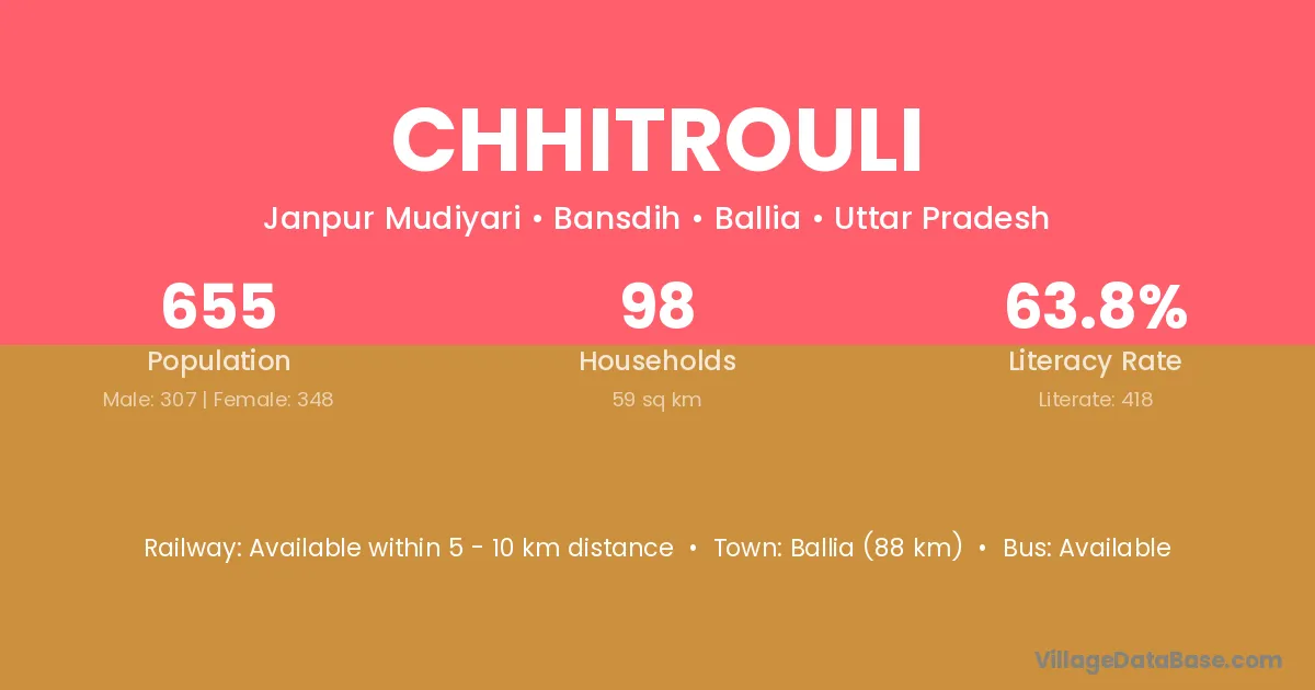
Chhitrouli village is located in the Bansdih Tehsil of the Ballia district in Uttar Pradesh .
Block / Tehsil → Bansdih
District → Ballia
State → Uttar Pradesh
Chhitrouli village has a total population of 655 people, of which 307 are males and 348 are females.
The literacy rate of Chhitrouli village is 63.82%. Male literacy stands at 75.57% and female literacy at 53.45%.
There are approximately 98 households in Chhitrouli village.
Ballia (88 km) is the nearest town to Chhitrouli village for major economic activities and is located approximately 88 km away.
The population of Chhitrouli village is distributed between literate and illiterate residents as follows:
| Particulars | Male | Female | Total |
|---|---|---|---|
| Literate | 232 | 186 | 418 |
| Illiterate | 75 | 162 | 237 |
| Total | 307 | 348 | 655 |
Source: Census 2011
| Village | District |
|---|---|
| Achhuhi | Ballia |
| Bouri | Ballia |
| Bouri | Ballia |
| Dhan Pallia Taluka Bansdih | Ballia |
| Dhanouti Taluka Majhos | Ballia |
| Gopalpur Kala | Ambedkar Nagar |
| Gopalpur Kala | Ballia |
| Gopalpur Khurd | Muzaffarpur |
| Gopalpur Khurd | Supaul |
| Gopalpur Khurd | Ballia |
| Gopalpur Khurd | Sultanpur |
| Harizanpur | Ballia |
| Harizanpur | Gorakhpur |
| Pahiya Taluka Majhos | Ballia |
| Saphi | Ballia |
| Saphi | Basti |
| Saphi | Kushinagar |
| Semri Rampur | Ballia |
| Sultanpur Taluka Majhos | Ballia |
No reviews yet. Be the first to review this village!
Available within 5 - 10 km distance
Available within 10+ km distance
Available within 5 - 10 km distance