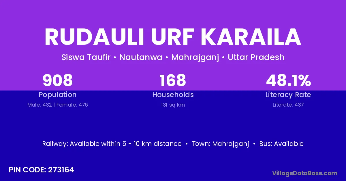
Rudauli Urf Karaila village is located in the Nautanwa Tehsil of the Mahrajganj district in Uttar Pradesh .
Block / Tehsil → Nautanwa
District → Mahrajganj
State → Uttar Pradesh
According to Census 2011 information, the village code of Rudauli Urf Karaila village is 273164.
Rudauli Urf Karaila village has a total population of 908 people, of which 432 are males and 476 are females.
The literacy rate of Rudauli Urf Karaila village is 48.13%. Male literacy stands at 62.96% and female literacy at 34.66%.
There are approximately 168 households in Rudauli Urf Karaila village.
Mahrajganj is the nearest town to Rudauli Urf Karaila village for major economic activities
The population of Rudauli Urf Karaila village is distributed between literate and illiterate residents as follows:
| Particulars | Male | Female | Total |
|---|---|---|---|
| Literate | 272 | 165 | 437 |
| Illiterate | 160 | 311 | 471 |
| Total | 432 | 476 | 908 |
Source: Census 2011
| Village | District |
|---|---|
| Amava | Gonda |
| Amava | Mahrajganj |
| Bargadva Ayodhya | Mahrajganj |
| Belva Buzurg | Mahrajganj |
| Dashrath Pur | Faizabad |
| Dashrath Pur | Mahrajganj |
| Dhotihva | Mahrajganj |
| Hanuman Garhiya | Mahrajganj |
| Kajari | Gaya |
| Kajari | Katihar |
| Kajari | Mahrajganj |
| Karailiya | Mahrajganj |
| Moglaha | Purnia |
| Moglaha | Mahrajganj |
| Semarhava | Mahrajganj |
| Tenduhi | Banda |
| Tenduhi | Deoria |
| Tenduhi | Mahrajganj |
No reviews yet. Be the first to review this village!
Available within 5 - 10 km distance
Available within village
Available within 5 - 10 km distance