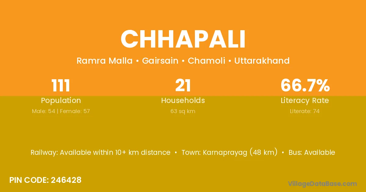
Chhapali village is located in the Gairsain Tehsil of the Chamoli district in Uttarakhand .
Block / Tehsil → Gairsain
District → Chamoli
State → Uttarakhand
According to Census 2011 information, the village code of Chhapali village is 246428.
Chhapali village has a total population of 111 people, of which 54 are males and 57 are females.
The literacy rate of Chhapali village is 66.67%. Male literacy stands at 79.63% and female literacy at 54.39%.
There are approximately 21 households in Chhapali village.
Karnaprayag (48 km) is the nearest town to Chhapali village for major economic activities and is located approximately 48 km away.
The population of Chhapali village is distributed between literate and illiterate residents as follows:
| Particulars | Male | Female | Total |
|---|---|---|---|
| Literate | 43 | 31 | 74 |
| Illiterate | 11 | 26 | 37 |
| Total | 54 | 57 | 111 |
Source: Census 2011
| Village | District |
|---|---|
| Ghandiyal Khalsa Laga Chapal | Chamoli |
| Ghandiyal Lagga Chhapali | Chamoli |
| Kulagar | Chamoli |
| Kumoli Raiwan | Chamoli |
| Majerasar | Chamoli |
| Mehargaon | Jalgaon |
| Mehargaon | Chamoli |
| Nail Laga Farakande | Chamoli |
| Pajyana | Chamoli |
| Pajyana | Chamoli |
| Paramghat Laga Chhapali | Chamoli |
| Ruriya Tal | Chamoli |
| Silakot | Chamoli |
| Silakot | Barddhaman |
No reviews yet. Be the first to review this village!
Available within 10+ km distance
Available within 10+ km distance
Available within 10+ km distance