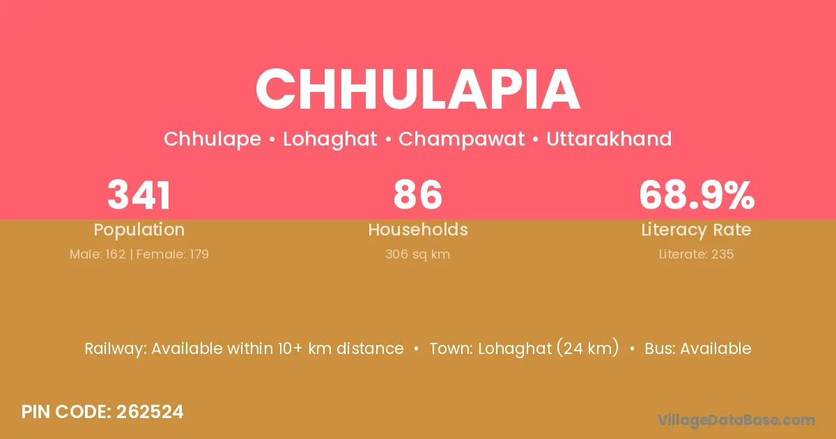
Chhulapia village is located in the Lohaghat Tehsil of the Champawat district in Uttarakhand .
Block / Tehsil → Lohaghat
District → Champawat
State → Uttarakhand
According to Census 2011 information, the village code of Chhulapia village is 262524.
Chhulapia village has a total population of 341 people, of which 162 are males and 179 are females.
The literacy rate of Chhulapia village is 68.91%. Male literacy stands at 82.72% and female literacy at 56.42%.
There are approximately 86 households in Chhulapia village.
Lohaghat (24 km) is the nearest town to Chhulapia village for major economic activities and is located approximately 24 km away.
The population of Chhulapia village is distributed between literate and illiterate residents as follows:
| Particulars | Male | Female | Total |
|---|---|---|---|
| Literate | 134 | 101 | 235 |
| Illiterate | 28 | 78 | 106 |
| Total | 162 | 179 | 341 |
Source: Census 2011
| Village | District |
|---|---|
| Adkhandi | Champawat |
| Ban Kandiya | Champawat |
| Devli Maphi | Champawat |
| Doba | Lohardaga |
| Doba | Guna |
| Doba | Champawat |
| Doba | Garhwal |
| Doba | Garhwal |
| Doba | Nainital |
| Dungraorn | Champawat |
| Ezra | Champawat |
| Naumana | Champawat |
| Padasawn | Champawat |
| Raighaon | Champawat |
| Surkot | Champawat |
| Tari Gaon | Kamrup |
| Tari Gaon | Champawat |
| Tari Gaon | Pithoragarh |
No reviews yet. Be the first to review this village!
Available within 10+ km distance
Available within 10+ km distance
Available within <5 km distance