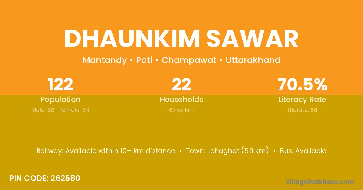
Dhaunkim Sawar village is located in the Pati Tehsil of the Champawat district in Uttarakhand .
Block / Tehsil → Pati
District → Champawat
State → Uttarakhand
According to Census 2011 information, the village code of Dhaunkim Sawar village is 262580.
Dhaunkim Sawar village has a total population of 122 people, of which 58 are males and 64 are females.
The literacy rate of Dhaunkim Sawar village is 70.49%. Male literacy stands at 84.48% and female literacy at 57.81%.
There are approximately 22 households in Dhaunkim Sawar village.
Lohaghat (59 km) is the nearest town to Dhaunkim Sawar village for major economic activities and is located approximately 59 km away.
The population of Dhaunkim Sawar village is distributed between literate and illiterate residents as follows:
| Particulars | Male | Female | Total |
|---|---|---|---|
| Literate | 49 | 37 | 86 |
| Illiterate | 9 | 27 | 36 |
| Total | 58 | 64 | 122 |
Source: Census 2011
| Village | District |
|---|---|
| Chaura Guth | Champawat |
| Dantola | Champawat |
| Dantola | Pithoragarh |
| Fularakot | Champawat |
| Gagar | Narmada |
| Gagar | Rajgarh |
| Gagar | Hoshiarpur |
| Gagar | Champawat |
| Gagar | Nainital |
| Gagrarh | Champawat |
| Kanikot Lagga Chora Guth | Champawat |
| Karki Chhana | Champawat |
| Kimar | Champawat |
| Kimar | Garhwal |
| Mantande | Champawat |
| Pipal Dhing | Champawat |
| Toli Katheri | Champawat |
No reviews yet. Be the first to review this village!
Available within 10+ km distance
Available within 10+ km distance
Available within 10+ km distance