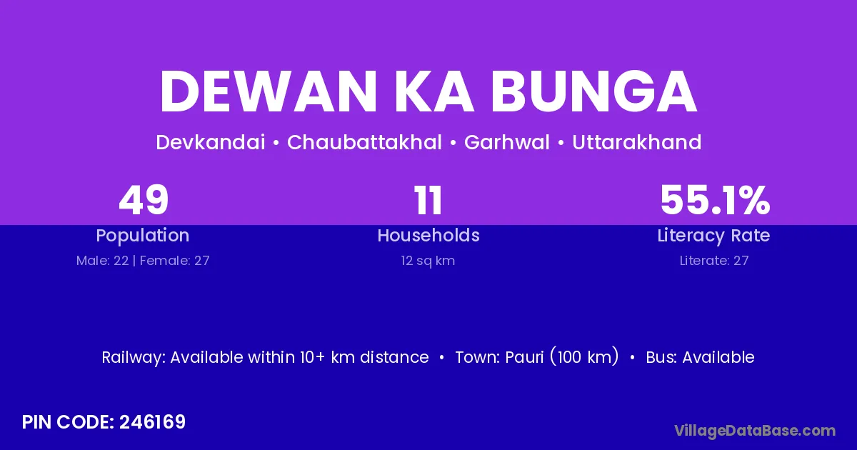
Dewan Ka Bunga village is located in the Chaubattakhal Tehsil of the Garhwal district in Uttarakhand .
Block / Tehsil → Chaubattakhal
District → Garhwal
State → Uttarakhand
According to Census 2011 information, the village code of Dewan Ka Bunga village is 246169.
Dewan Ka Bunga village has a total population of 49 people, of which 22 are males and 27 are females.
The literacy rate of Dewan Ka Bunga village is 55.10%. Male literacy stands at 63.64% and female literacy at 48.15%.
There are approximately 11 households in Dewan Ka Bunga village.
Pauri (100 km) is the nearest town to Dewan Ka Bunga village for major economic activities and is located approximately 100 km away.
The population of Dewan Ka Bunga village is distributed between literate and illiterate residents as follows:
| Particulars | Male | Female | Total |
|---|---|---|---|
| Literate | 14 | 13 | 27 |
| Illiterate | 8 | 14 | 22 |
| Total | 22 | 27 | 49 |
Source: Census 2011
| Village | District |
|---|---|
| Badiyana | Garhwal |
| Bhanswara | Garhwal |
| Bhanswara | Garhwal |
| Charkandai | Garhwal |
| Dev Kandai Malli | Garhwal |
| Dev Kendari Talli | Garhwal |
| Gaokhand | Garhwal |
| Halad | Garhwal |
| Kwirali | Chamoli |
| Kwirali | Garhwal |
| Kwirali | Garhwal |
| Paniya | Lower Subansiri |
| Paniya | Amreli |
| Paniya | Amreli |
| Paniya | Dohad |
| Paniya | Panch Mahals |
| Paniya | Rajgarh |
| Paniya | Rajsamand |
| Paniya | Garhwal |
| Shivladh | Garhwal |
| Sungher Khal | Garhwal |
No reviews yet. Be the first to review this village!
Available within 10+ km distance
Available within <5 km distance
Available within <5 km distance