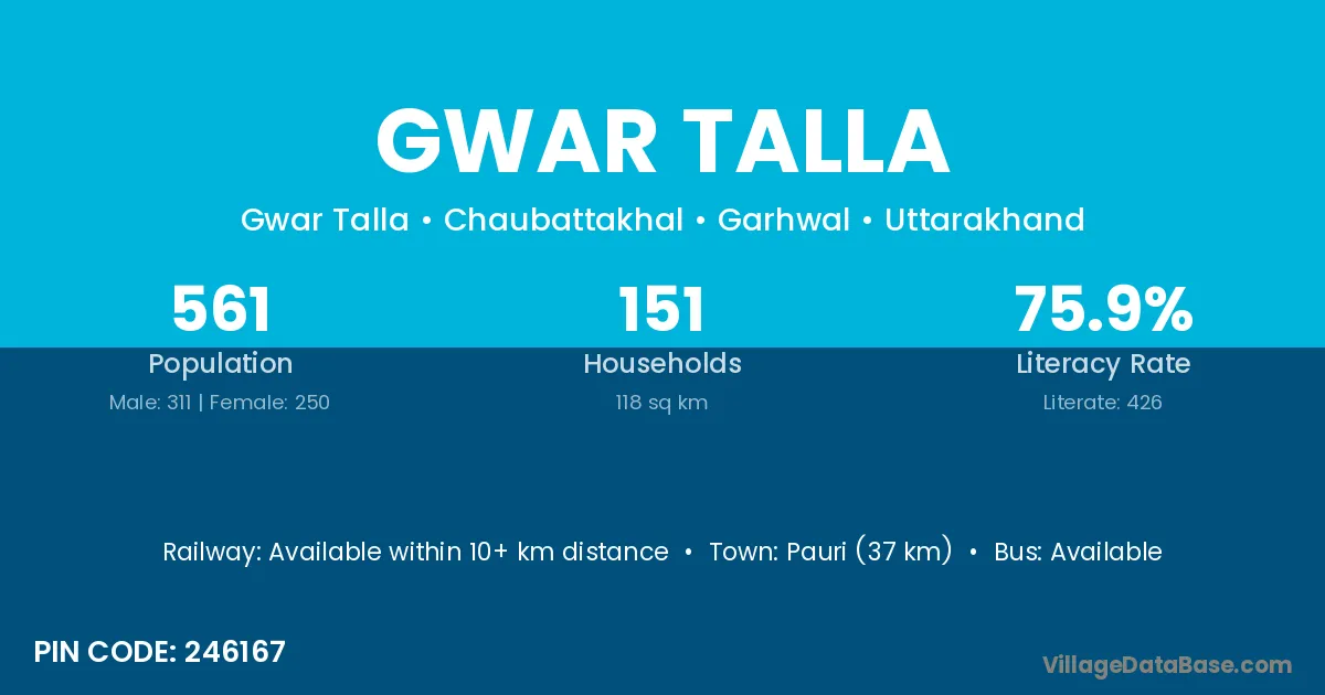
Gwar Talla village is located in the Chaubattakhal Tehsil of the Garhwal district in Uttarakhand .
Block / Tehsil → Chaubattakhal
District → Garhwal
State → Uttarakhand
According to Census 2011 information, the village code of Gwar Talla village is 246167.
Gwar Talla village has a total population of 561 people, of which 311 are males and 250 are females.
The literacy rate of Gwar Talla village is 75.94%. Male literacy stands at 80.06% and female literacy at 70.80%.
There are approximately 151 households in Gwar Talla village.
Pauri (37 km) is the nearest town to Gwar Talla village for major economic activities and is located approximately 37 km away.
The population of Gwar Talla village is distributed between literate and illiterate residents as follows:
| Particulars | Male | Female | Total |
|---|---|---|---|
| Literate | 249 | 177 | 426 |
| Illiterate | 62 | 73 | 135 |
| Total | 311 | 250 | 561 |
Source: Census 2011
| Village | District |
|---|---|
| Bamoli | Mathura |
| Bamoli | Garhwal |
| Bamoli | Garhwal |
| Bhair Gaon | Garhwal |
| Bhair Gaon | Garhwal |
| Bhair Gaon | Garhwal |
| Jakholu | Garhwal |
| Manjadi Malli | Garhwal |
| Manjari Talli | Garhwal |
| Math Gaon | Garhwal |
| Math Gaon | Garhwal |
| Piparkhola | Garhwal |
| Rikheda | Garhwal |
| Saim | Garhwal |
| Saim | Garhwal |
| Sakida | Garhwal |
| Thapli Talli | Garhwal |
No reviews yet. Be the first to review this village!
Available within 10+ km distance
Available within village
Available within village