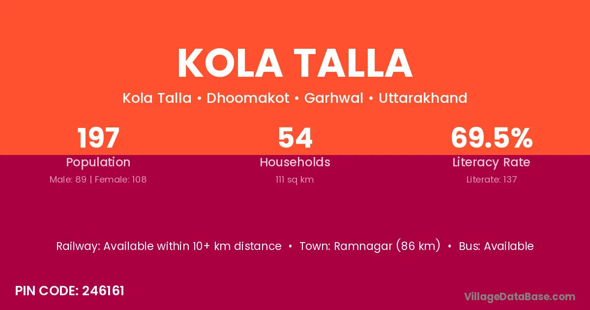
Kola Talla village is located in the Dhoomakot Tehsil of the Garhwal district in Uttarakhand .
Block / Tehsil → Dhoomakot
District → Garhwal
State → Uttarakhand
According to Census 2011 information, the village code of Kola Talla village is 246161.
Kola Talla village has a total population of 197 people, of which 89 are males and 108 are females.
The literacy rate of Kola Talla village is 69.54%. Male literacy stands at 84.27% and female literacy at 57.41%.
There are approximately 54 households in Kola Talla village.
Ramnagar (86 km) is the nearest town to Kola Talla village for major economic activities and is located approximately 86 km away.
The population of Kola Talla village is distributed between literate and illiterate residents as follows:
| Particulars | Male | Female | Total |
|---|---|---|---|
| Literate | 75 | 62 | 137 |
| Illiterate | 14 | 46 | 60 |
| Total | 89 | 108 | 197 |
Source: Census 2011
| Village | District |
|---|---|
| Adwara Talla | Garhwal |
| Adwara Walla | Garhwal |
| Bhoun | Garhwal |
| Chetoli Palli | Garhwal |
| Dangal Gaon | Garhwal |
| Dudera | Garhwal |
| Kola Malla | Garhwal |
| Matiyar | Satna |
| Matiyar | Garhwal |
| Noniya Khet | Garhwal |
| Phadkandae | Garhwal |
| Salana | Kamrup Metropolitan |
| Salana | Mandi |
| Salana | Shimla |
| Salana | Sirmaur |
| Salana | Solan |
| Salana | Una |
| Salana | Ludhiana |
| Salana | Garhwal |
| Salana | Garhwal |
No reviews yet. Be the first to review this village!
Available within 10+ km distance
Available within village
Available within village