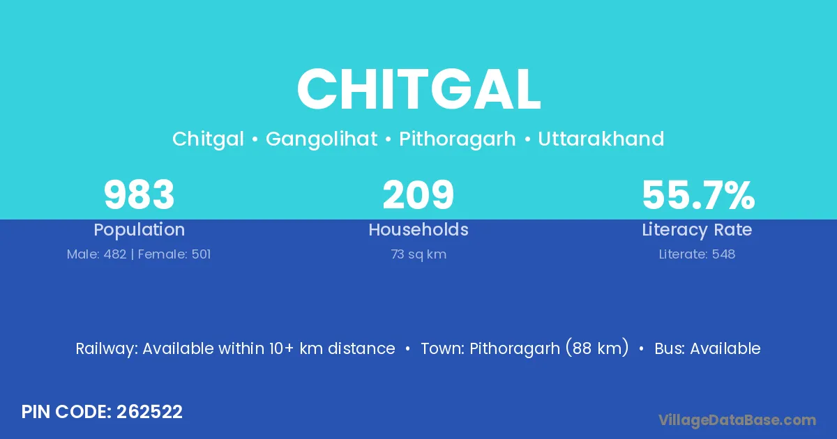
Chitgal village is located in the Gangolihat Tehsil of the Pithoragarh district in Uttarakhand .
Block / Tehsil → Gangolihat
District → Pithoragarh
State → Uttarakhand
According to Census 2011 information, the village code of Chitgal village is 262522.
Chitgal village has a total population of 983 people, of which 482 are males and 501 are females.
The literacy rate of Chitgal village is 55.75%. Male literacy stands at 63.69% and female literacy at 48.10%.
There are approximately 209 households in Chitgal village.
Pithoragarh (88 km) is the nearest town to Chitgal village for major economic activities and is located approximately 88 km away.
The population of Chitgal village is distributed between literate and illiterate residents as follows:
| Particulars | Male | Female | Total |
|---|---|---|---|
| Literate | 307 | 241 | 548 |
| Illiterate | 175 | 260 | 435 |
| Total | 482 | 501 | 983 |
Source: Census 2011
| Village | District |
|---|---|
| Bahalkote | Pithoragarh |
| Birgoli | Bastar |
| Birgoli | Pithoragarh |
| Garali | Pithoragarh |
| Garali | Pithoragarh |
| Hat | Jind |
| Hat | Chamba |
| Hat | Kullu |
| Hat | Chamoli |
| Hat | Pithoragarh |
| Hat | Rudraprayag |
| Jiwal | Pithoragarh |
| Madhye Purana Dak Bangla | Pithoragarh |
| Malla Garkhe | Pithoragarh |
| Mancote | Pithoragarh |
| Nargwari | Bageshwar |
| Nargwari | Pithoragarh |
| Rawal Gaon | Pithoragarh |
| Rawal Gaon | Pithoragarh |
| Tunar Suzi Bisodi | Pithoragarh |
No reviews yet. Be the first to review this village!
Available within 10+ km distance
Available within 10+ km distance
Available within 10+ km distance