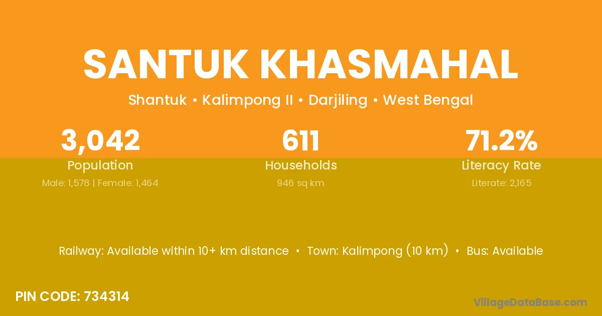
Santuk Khasmahal village is located in the Kalimpong II Subdivision of the Darjiling district in West Bengal .
Block / Subdivision → Kalimpong II
District → Darjiling
State → West Bengal
According to Census 2011 information, the village code of Santuk Khasmahal village is 734314.
Santuk Khasmahal village has a total population of 3,042 people, of which 1,578 are males and 1,464 are females.
The literacy rate of Santuk Khasmahal village is 71.17%. Male literacy stands at 77.50% and female literacy at 64.34%.
There are approximately 611 households in Santuk Khasmahal village.
Kalimpong (10 km) is the nearest town to Santuk Khasmahal village for major economic activities and is located approximately 10 km away.
The population of Santuk Khasmahal village is distributed between literate and illiterate residents as follows:
| Particulars | Male | Female | Total |
|---|---|---|---|
| Literate | 1,223 | 942 | 2,165 |
| Illiterate | 355 | 522 | 877 |
| Total | 1,578 | 1,464 | 3,042 |
Source: Census 2011
| Village | District |
|---|---|
| Bokhim Khasmahal | Darjiling |
| Chumang Forest | Darjiling |
| Dalapachan Khasmahal | Darjiling |
| Dalapchan Ridge Reserve Forest | Darjiling |
| Dalapchan Slip Reserve Forest | Darjiling |
| Git Beong Khasmahal | Darjiling |
| Git Dubling Khasmahal | Darjiling |
| Paiyong Khasmahal | Darjiling |
| Paygang Khasmahal | Darjiling |
| Saihur Forest | Darjiling |
| Sangser Khasmahal | Darjiling |
No reviews yet. Be the first to review this village!
Available within 10+ km distance
Available within 10+ km distance
Available within 5 - 10 km distance