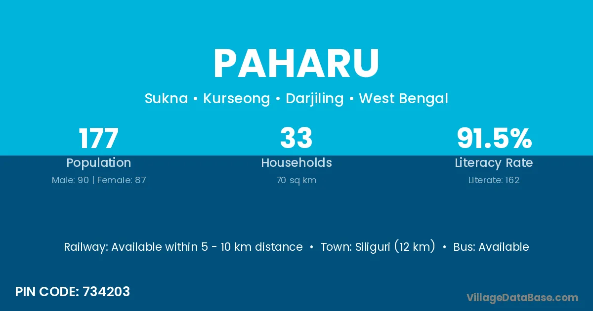
Paharu village is located in the Kurseong Subdivision of the Darjiling district in West Bengal .
Block / Subdivision → Kurseong
District → Darjiling
State → West Bengal
According to Census 2011 information, the village code of Paharu village is 734203.
Paharu village has a total population of 177 people, of which 90 are males and 87 are females.
The literacy rate of Paharu village is 91.53%. Male literacy stands at 93.33% and female literacy at 89.66%.
There are approximately 33 households in Paharu village.
Siliguri (12 km) is the nearest town to Paharu village for major economic activities and is located approximately 12 km away.
The population of Paharu village is distributed between literate and illiterate residents as follows:
| Particulars | Male | Female | Total |
|---|---|---|---|
| Literate | 84 | 78 | 162 |
| Illiterate | 6 | 9 | 15 |
| Total | 90 | 87 | 177 |
Source: Census 2011
| Village | District |
|---|---|
| Cart Road | Darjiling |
| Champasari Forest | Darjiling |
| Chhota Adalpur | Darjiling |
| Choklong Forest | Darjiling |
| Gola Forest | Darjiling |
| Mohanadi Forest | Darjiling |
| Shalbari Chhat Dwitiya Khanda | Darjiling |
| Sitong Forest | Darjiling |
| Sivok Hill Forest | Darjiling |
| Sukna Forest | Darjiling |
| Sukna Pratham Khanda | Darjiling |
No reviews yet. Be the first to review this village!
Available within 5 - 10 km distance
Available within 5 - 10 km distance
Available within 5 - 10 km distance