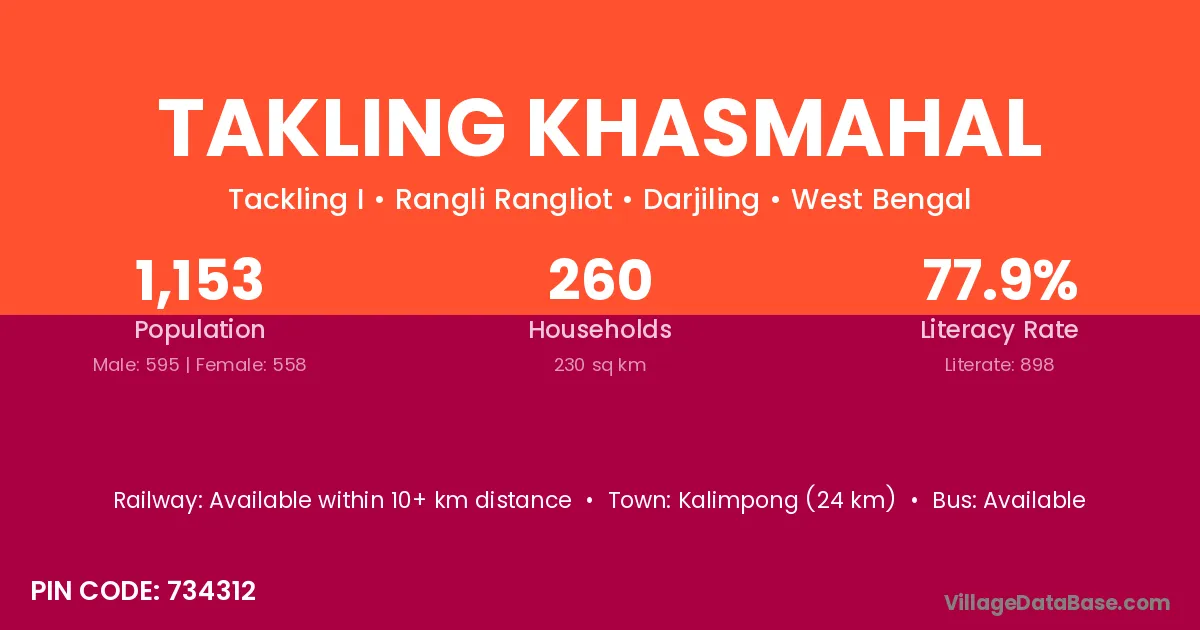
Takling Khasmahal village is located in the Rangli Rangliot Subdivision of the Darjiling district in West Bengal .
Block / Subdivision → Rangli Rangliot
District → Darjiling
State → West Bengal
According to Census 2011 information, the village code of Takling Khasmahal village is 734312.
Takling Khasmahal village has a total population of 1,153 people, of which 595 are males and 558 are females.
The literacy rate of Takling Khasmahal village is 77.88%. Male literacy stands at 82.86% and female literacy at 72.58%.
There are approximately 260 households in Takling Khasmahal village.
Kalimpong (24 km) is the nearest town to Takling Khasmahal village for major economic activities and is located approximately 24 km away.
The population of Takling Khasmahal village is distributed between literate and illiterate residents as follows:
| Particulars | Male | Female | Total |
|---|---|---|---|
| Literate | 493 | 405 | 898 |
| Illiterate | 102 | 153 | 255 |
| Total | 595 | 558 | 1,153 |
Source: Census 2011
| Village | District |
|---|---|
| Bara Mungwa | Darjiling |
| Chegra Khasmahal | Darjiling |
| Chhota Mungwa | Darjiling |
| Hum Tukdah Khasmahal | Darjiling |
| Kolbong Khasmahal | Darjiling |
| Lapchu Tea Garden | Darjiling |
| Lingding Khasmahal | Darjiling |
| Peshok Tea Garden | Darjiling |
| Rayak Khasmahal | Darjiling |
| Soriang Khasmahal | Darjiling |
| Teesta Valley Forest | Darjiling |
No reviews yet. Be the first to review this village!
Available within 10+ km distance
Available within 5 - 10 km distance
Available within <5 km distance