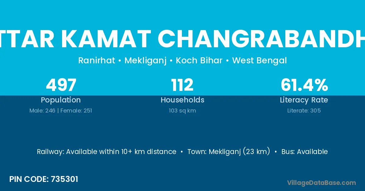
Uttar Kamat Changrabandha village is located in the Mekliganj Subdivision of the Koch Bihar district in West Bengal .
Block / Subdivision → Mekliganj
District → Koch Bihar
State → West Bengal
According to Census 2011 information, the village code of Uttar Kamat Changrabandha village is 735301.
Uttar Kamat Changrabandha village has a total population of 497 people, of which 246 are males and 251 are females.
The literacy rate of Uttar Kamat Changrabandha village is 61.37%. Male literacy stands at 70.73% and female literacy at 52.19%.
There are approximately 112 households in Uttar Kamat Changrabandha village.
Mekliganj (23 km) is the nearest town to Uttar Kamat Changrabandha village for major economic activities and is located approximately 23 km away.
The population of Uttar Kamat Changrabandha village is distributed between literate and illiterate residents as follows:
| Particulars | Male | Female | Total |
|---|---|---|---|
| Literate | 174 | 131 | 305 |
| Illiterate | 72 | 120 | 192 |
| Total | 246 | 251 | 497 |
Source: Census 2011
| Village | District |
|---|---|
| Chhat Kamat Changrabandha | Koch Bihar |
| Dakshin Alokjhari | Koch Bihar |
| Dakshin Bokna Bandha | Koch Bihar |
| Deuti Khata | Koch Bihar |
| Dhulia Khalisa | Koch Bihar |
| Dora Dabri | Koch Bihar |
| Paschim Dhulia Khalisa | Koch Bihar |
| Purbba Hemkumari | Koch Bihar |
| Uttar Alokjhari | Koch Bihar |
| Uttar Boknabandha | Koch Bihar |
| Uttar Hemkumari | Koch Bihar |
No reviews yet. Be the first to review this village!
Available within 10+ km distance
Available within 5 - 10 km distance
Available within village