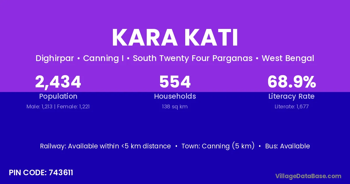
Kara Kati village is located in the Canning I Subdivision of the South Twenty Four Parganas district in West Bengal .
Block / Subdivision → Canning I
District → South Twenty Four Parganas
State → West Bengal
According to Census 2011 information, the village code of Kara Kati village is 743611.
Kara Kati village has a total population of 2,434 people, of which 1,213 are males and 1,221 are females.
The literacy rate of Kara Kati village is 68.90%. Male literacy stands at 75.10% and female literacy at 62.74%.
There are approximately 554 households in Kara Kati village.
Canning (5 km) is the nearest town to Kara Kati village for major economic activities and is located approximately 5 km away.
The population of Kara Kati village is distributed between literate and illiterate residents as follows:
| Particulars | Male | Female | Total |
|---|---|---|---|
| Literate | 911 | 766 | 1,677 |
| Illiterate | 302 | 455 | 757 |
| Total | 1,213 | 1,221 | 2,434 |
Source: Census 2011
No reviews yet. Be the first to review this village!
Available within <5 km distance
Available within <5 km distance
Available within <5 km distance