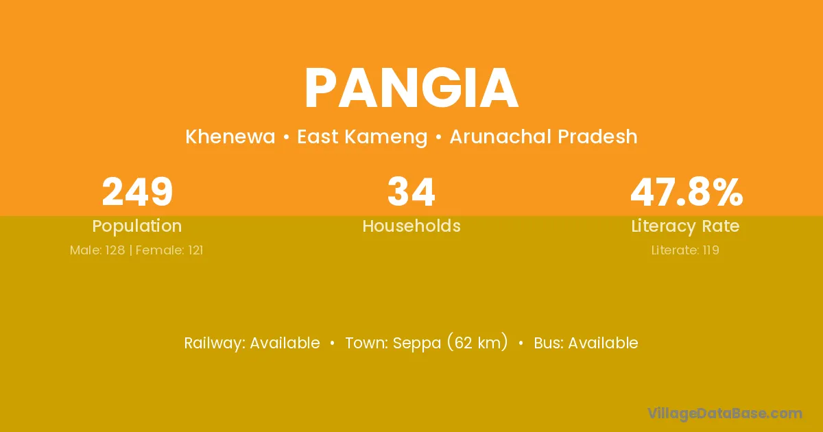
Pangia village is located in the Khenewa Circle of the East Kameng district in Arunachal Pradesh .
Block / Circle → Khenewa
District → East Kameng
State → Arunachal Pradesh
Pangia village has a total population of 249 people, of which 128 are males and 121 are females.
The literacy rate of Pangia village is 47.79%. Male literacy stands at 59.38% and female literacy at 35.54%.
There are approximately 34 households in Pangia village.
Seppa (62 km) is the nearest town to Pangia village for major economic activities and is located approximately 62 km away.
The population of Pangia village is distributed between literate and illiterate residents as follows:
| Particulars | Male | Female | Total |
|---|---|---|---|
| Literate | 76 | 43 | 119 |
| Illiterate | 52 | 78 | 130 |
| Total | 128 | 121 | 249 |
Source: Census 2011
| Village | District |
|---|---|
| Chaling | East Kameng |
| Chaling | Lahul & Spiti |
| Jokhia | East Kameng |
| Jomoh | East Kameng |
| Kapa | East Kameng |
| Kapa | Durg |
| Kapa | Kabeerdham |
| Kapa | Rajnandgaon |
| Kapa | Jabalpur |
| Kapa | Pithoragarh |
| Kawarang | East Kameng |
| Pordung Sullung | East Kameng |
| Rawa | East Kameng |
| Rawa | Korba |
| Rawa | Kurukshetra |
| Rawa | Mewat |
| Rawa | Kangra |
| Rawa | Kinnaur |
| Rawa | Kinnaur |
| Rawa | Betul |
| Rawa | Jalaun |
| Rawa | Meerut |
| Sefew | East Kameng |
| Waii | East Kameng |
| Wallong | East Kameng |
| Warrom | East Kameng |
No reviews yet. Be the first to review this village!
Available
Available within 10+ km distance
Available within 10+ km distance