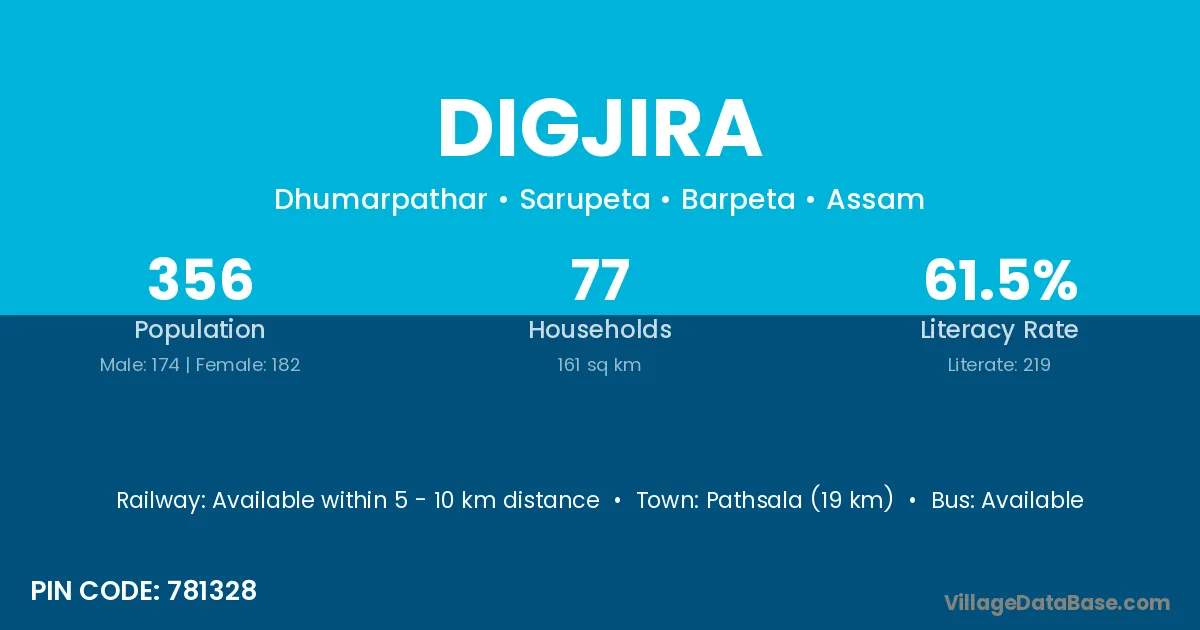
Digjira village is located in the Sarupeta Subdivision of the Barpeta district in Assam .
Block / Subdivision → Sarupeta
District → Barpeta
State → Assam
According to Census 2011 information, the village code of Digjira village is 781328.
Digjira village has a total population of 356 people, of which 174 are males and 182 are females.
The literacy rate of Digjira village is 61.52%. Male literacy stands at 66.67% and female literacy at 56.59%.
There are approximately 77 households in Digjira village.
Pathsala (19 km) is the nearest town to Digjira village for major economic activities and is located approximately 19 km away.
The population of Digjira village is distributed between literate and illiterate residents as follows:
| Particulars | Male | Female | Total |
|---|---|---|---|
| Literate | 116 | 103 | 219 |
| Illiterate | 58 | 79 | 137 |
| Total | 174 | 182 | 356 |
Source: Census 2011
| Village | District |
|---|---|
| Chengli Mari | Barpeta |
| Chinapatani | Barpeta |
| Dhemchar Pathar | Barpeta |
| Dhumar Pathar | Barpeta |
| Dhupal Para | Barpeta |
| Hallang Bari | Barpeta |
| Kathalmuri Ghat | Barpeta |
| Maj Gaon | Barpeta |
| Maj Gaon | Dhemaji |
| Maj Gaon | Kamrup |
| Maj Gaon | Karbi Anglong |
| Maj Gaon | Karbi Anglong |
| Maj Gaon | Tinsukia |
| Maj Gaon | Garhwal |
| Maj Gaon | Garhwal |
| Pata Gaon | Barpeta |
| Roumari | Baksa |
| Roumari | Barpeta |
| Roumari | Goalpara |
| Roumari | Kamrup |
| Roumari | Kamrup |
| Roumari | Kamrup |
| Roumari | Morigaon |
| Soto Kamar | Barpeta |
No reviews yet. Be the first to review this village!
Available within 5 - 10 km distance
Available within <5 km distance
Available within <5 km distance