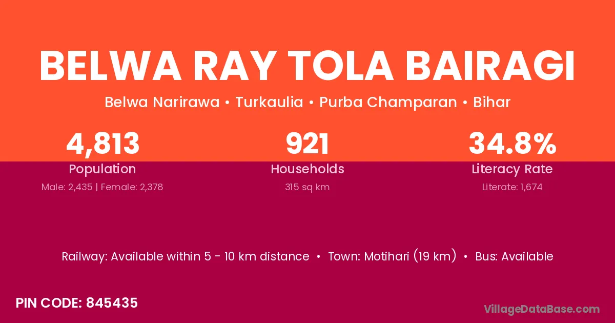
Belwa Ray Tola Bairagi village is located in the Turkaulia Subdivision of the Purba Champaran district in Bihar .
Block / Subdivision → Turkaulia
District → Purba Champaran
State → Bihar
According to Census 2011 information, the village code of Belwa Ray Tola Bairagi village is 845435.
Belwa Ray Tola Bairagi village has a total population of 4,813 people, of which 2,435 are males and 2,378 are females.
The literacy rate of Belwa Ray Tola Bairagi village is 34.78%. Male literacy stands at 42.96% and female literacy at 26.41%.
There are approximately 921 households in Belwa Ray Tola Bairagi village.
Motihari (19 km) is the nearest town to Belwa Ray Tola Bairagi village for major economic activities and is located approximately 19 km away.
The population of Belwa Ray Tola Bairagi village is distributed between literate and illiterate residents as follows:
| Particulars | Male | Female | Total |
|---|---|---|---|
| Literate | 1,046 | 628 | 1,674 |
| Illiterate | 1,389 | 1,750 | 3,139 |
| Total | 2,435 | 2,378 | 4,813 |
Source: Census 2011
No reviews yet. Be the first to review this village!
Available within 5 - 10 km distance
Available within 10+ km distance
Available within village