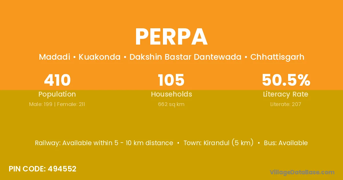
Perpa village is located in the Kuakonda Tehsil of the Dakshin Bastar Dantewada district in Chhattisgarh .
Block / Tehsil → Kuakonda
District → Dakshin Bastar Dantewada
State → Chhattisgarh
According to Census 2011 information, the village code of Perpa village is 494552.
Perpa village has a total population of 410 people, of which 199 are males and 211 are females.
The literacy rate of Perpa village is 50.49%. Male literacy stands at 58.29% and female literacy at 43.13%.
There are approximately 105 households in Perpa village.
Kirandul (5 km) is the nearest town to Perpa village for major economic activities and is located approximately 5 km away.
The population of Perpa village is distributed between literate and illiterate residents as follows:
| Particulars | Male | Female | Total |
|---|---|---|---|
| Literate | 116 | 91 | 207 |
| Illiterate | 83 | 120 | 203 |
| Total | 199 | 211 | 410 |
Source: Census 2011
No reviews yet. Be the first to review this village!
Available within 5 - 10 km distance
Available
Available within 5 - 10 km distance