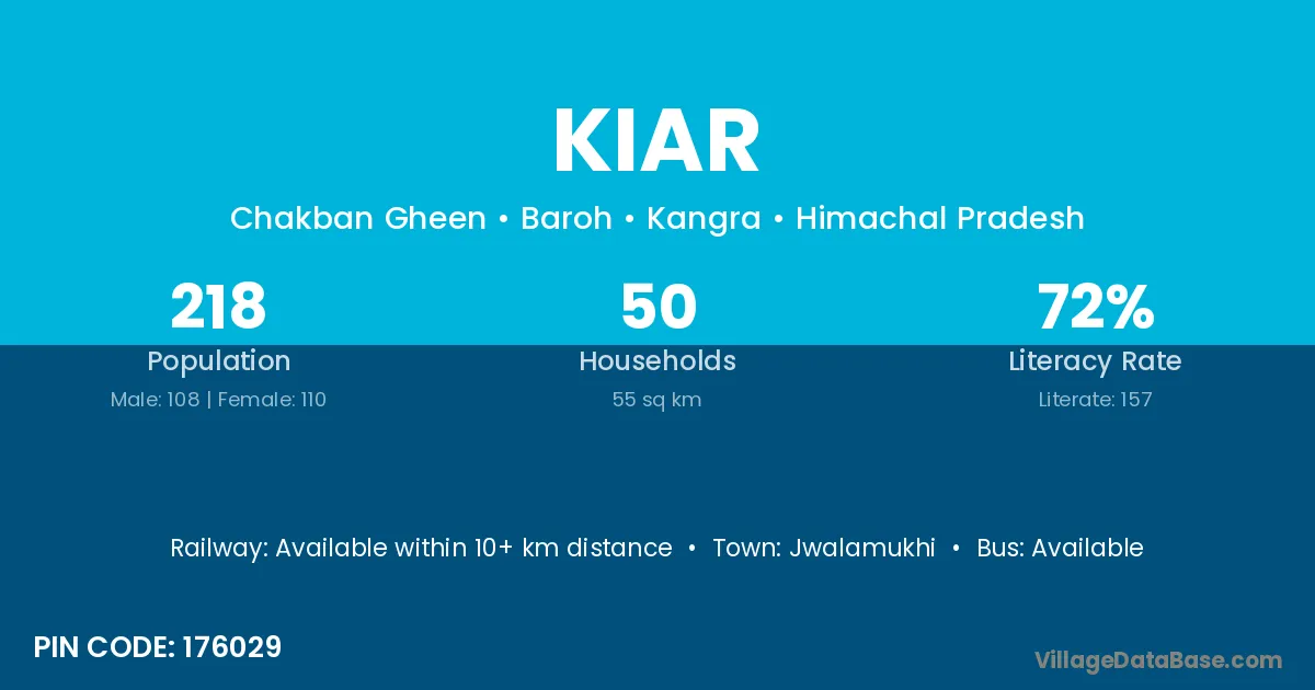
Kiar village is located in the Baroh Tehsil of the Kangra district in Himachal Pradesh .
Block / Tehsil → Baroh
District → Kangra
State → Himachal Pradesh
According to Census 2011 information, the village code of Kiar village is 176029.
Kiar village has a total population of 218 people, of which 108 are males and 110 are females.
The literacy rate of Kiar village is 72.02%. Male literacy stands at 75.93% and female literacy at 68.18%.
There are approximately 50 households in Kiar village.
Jwalamukhi is the nearest town to Kiar village for major economic activities
The population of Kiar village is distributed between literate and illiterate residents as follows:
| Particulars | Male | Female | Total |
|---|---|---|---|
| Literate | 82 | 75 | 157 |
| Illiterate | 26 | 35 | 61 |
| Total | 108 | 110 | 218 |
Source: Census 2011
| Village | District |
|---|---|
| Balu Galoa | Kangra |
| Balu Galoa I | Kangra |
| Bariala | Kangra |
| Chakban Chhidar | Kangra |
| Chakban Gheen | Kangra |
| Chhal | Raigarh |
| Chhal | Kangra |
| Chhal | Kangra |
| Jharal | Kangra |
| Jol | Anand |
| Jol | Surat |
| Jol | Bilaspur |
| Jol | Bilaspur |
| Jol | Bilaspur |
| Jol | Hamirpur |
| Jol | Hamirpur |
| Jol | Hamirpur |
| Jol | Kangra |
| Jol | Kangra |
| Jol | Kangra |
| Jol | Kangra |
| Jol | Kangra |
| Jol | Kangra |
| Jol | Kangra |
| Jol | Kangra |
| Jol | Kangra |
| Jol | Mandi |
| Jol | Mandi |
| Jol | Sirmaur |
| Jol | Solan |
| Jol | Una |
| Jol | Rupnagar |
| Sohran | Kangra |
| Swar | Kangra |
| Swar | Mandi |
| Thathal | Kangra |
| Thathal | Shimla |
| Thathal | Una |
| Thathal | Hoshiarpur |
No reviews yet. Be the first to review this village!
Available within 10+ km distance
Available within village
Available within village