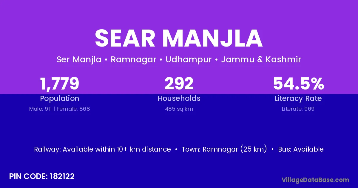
Sear Manjla village is located in the Ramnagar Tehsil of the Udhampur district in Jammu & Kashmir .
Block / Tehsil → Ramnagar
District → Udhampur
State → Jammu & Kashmir
According to Census 2011 information, the village code of Sear Manjla village is 182122.
Sear Manjla village has a total population of 1,779 people, of which 911 are males and 868 are females.
The literacy rate of Sear Manjla village is 54.47%. Male literacy stands at 64.87% and female literacy at 43.55%.
There are approximately 292 households in Sear Manjla village.
Ramnagar (25 km) is the nearest town to Sear Manjla village for major economic activities and is located approximately 25 km away.
The population of Sear Manjla village is distributed between literate and illiterate residents as follows:
| Particulars | Male | Female | Total |
|---|---|---|---|
| Literate | 591 | 378 | 969 |
| Illiterate | 320 | 490 | 810 |
| Total | 911 | 868 | 1,779 |
Source: Census 2011
| Village | District |
|---|---|
| Badhole | Udhampur |
| Bhugtharian | Udhampur |
| Chanunta | Udhampur |
| Dalsar | Udhampur |
| Dhandal | Mandi |
| Dhandal | Doda |
| Dhandal | Udhampur |
| Dhandal | Amritsar |
| Dhandal | Gurdaspur |
| Dhandal | Kapurthala |
| Kanah | Shimla |
| Kanah | Reasi |
| Kanah | Udhampur |
| Khathil Gango | Udhampur |
| Palarn | Udhampur |
| Punj Garian | Udhampur |
| Rumain | Udhampur |
| Sarsu | Gaya |
| Sarsu | Sirmaur |
| Sarsu | Udhampur |
No reviews yet. Be the first to review this village!
Available within 10+ km distance
Available within village
Available within <5 km distance