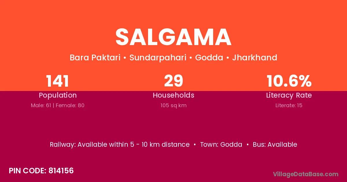
Salgama village is located in the Sundarpahari Subdivision of the Godda district in Jharkhand .
Block / Subdivision → Sundarpahari
District → Godda
State → Jharkhand
According to Census 2011 information, the village code of Salgama village is 814156.
Salgama village has a total population of 141 people, of which 61 are males and 80 are females.
The literacy rate of Salgama village is 10.64%. Male literacy stands at 19.67% and female literacy at 3.75%.
There are approximately 29 households in Salgama village.
Godda is the nearest town to Salgama village for major economic activities
The population of Salgama village is distributed between literate and illiterate residents as follows:
| Particulars | Male | Female | Total |
|---|---|---|---|
| Literate | 12 | 3 | 15 |
| Illiterate | 49 | 77 | 126 |
| Total | 61 | 80 | 141 |
Source: Census 2011
| Village | District |
|---|---|
| Kote | Kurung Kumey |
| Kote | Godda |
| Kote | Khunti |
| Kote | Udupi |
| Kote | Kolhapur |
| Kote | Dhenkanal |
| Kote | Ballia |
| Maspara | Dhubri |
| Maspara | Godda |
| Maspara | Pakur |
| Maspara | West Khasi Hills |
| Nadgoda | Godda |
| Pertara | Godda |
| Sabekundi | Godda |
| Sarmi | Saran |
| Sarmi | Dumka |
| Sarmi | Godda |
| Sidler | Godda |
| Singni | Dumka |
| Singni | Godda |
| Singni | Rampur |
| Talakpara | Godda |
| Tarobar | Godda |
| Tasgemthu | Godda |
No reviews yet. Be the first to review this village!
Available within 5 - 10 km distance
Available within 10+ km distance
Available within 10+ km distance