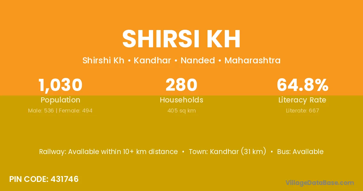
Shirsi Kh village is located in the Kandhar Tehsil of the Nanded district in Maharashtra .
Block / Tehsil → Kandhar
District → Nanded
State → Maharashtra
According to Census 2011 information, the village code of Shirsi Kh village is 431746.
Shirsi Kh village has a total population of 1,030 people, of which 536 are males and 494 are females.
The literacy rate of Shirsi Kh village is 64.76%. Male literacy stands at 71.83% and female literacy at 57.09%.
There are approximately 280 households in Shirsi Kh village.
Kandhar (31 km) is the nearest town to Shirsi Kh village for major economic activities and is located approximately 31 km away.
The population of Shirsi Kh village is distributed between literate and illiterate residents as follows:
| Particulars | Male | Female | Total |
|---|---|---|---|
| Literate | 385 | 282 | 667 |
| Illiterate | 151 | 212 | 363 |
| Total | 536 | 494 | 1,030 |
Source: Census 2011
| Village | District |
|---|---|
| Bramhwadi | Nanded |
| Bramhwadi | Nanded |
| Dewaichiwadi | Nanded |
| Gonar | Nanded |
| Hanmantwadi | Kolhapur |
| Hanmantwadi | Kolhapur |
| Hanmantwadi | Latur |
| Hanmantwadi | Latur |
| Hanmantwadi | Latur |
| Hanmantwadi | Nanded |
| Hanmantwadi | Satara |
| Kallali | Nanded |
| Khandgaon Hamid | Nanded |
| Madali | Nanded |
| Madali | Rudraprayag |
| Masalaga | Nanded |
| Narnali | Nanded |
| Rui | Barwani |
| Rui | Ahmadnagar |
| Rui | Bid |
| Rui | Chandrapur |
| Rui | Jalna |
| Rui | Kolhapur |
| Rui | Latur |
| Rui | Latur |
| Rui | Nagpur |
| Rui | Nanded |
| Rui | Nanded |
| Rui | Nanded |
| Rui | Nashik |
| Rui | Osmanabad |
| Rui | Osmanabad |
| Rui | Pune |
| Rui | Pune |
| Rui | Satara |
| Rui | Satara |
| Rui | Solapur |
| Rui | Solapur |
| Rui | Washim |
| Rui | Washim |
| Rui | Yavatmal |
| Sawargaon Nipani | Nanded |
No reviews yet. Be the first to review this village!
Available within 10+ km distance
Available within village
Available within 10+ km distance