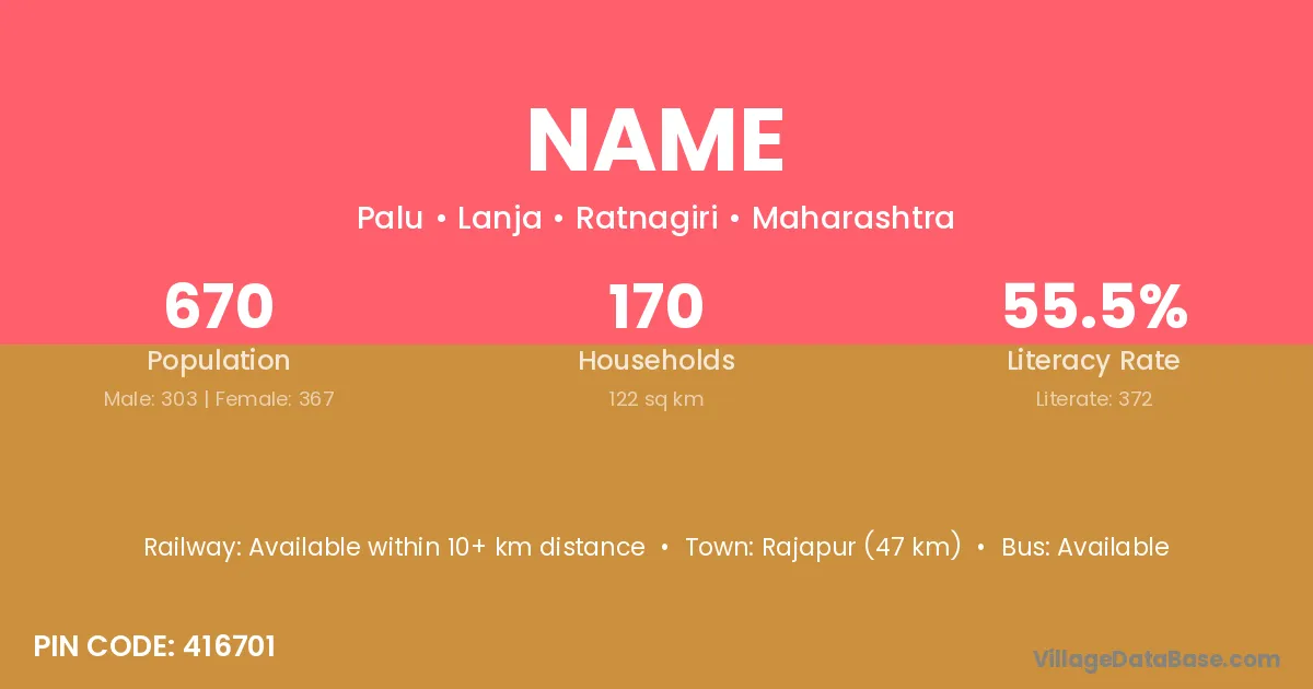
Name village is located in the Lanja Tehsil of the Ratnagiri district in Maharashtra .
Block / Tehsil → Lanja
District → Ratnagiri
State → Maharashtra
According to Census 2011 information, the village code of Name village is 416701.
Name village has a total population of 670 people, of which 303 are males and 367 are females.
The literacy rate of Name village is 55.52%. Male literacy stands at 65.02% and female literacy at 47.68%.
There are approximately 170 households in Name village.
Rajapur (47 km) is the nearest town to Name village for major economic activities and is located approximately 47 km away.
The population of Name village is distributed between literate and illiterate residents as follows:
| Particulars | Male | Female | Total |
|---|---|---|---|
| Literate | 197 | 175 | 372 |
| Illiterate | 106 | 192 | 298 |
| Total | 303 | 367 | 670 |
Source: Census 2011
| Village | District |
|---|---|
| Adavali | Pune |
| Adavali | Ratnagiri |
| Adavali | Ratnagiri |
| Baing | Ratnagiri |
| Bankhor | Sabar Kantha |
| Bankhor | Ratnagiri |
| Bhambed | Ratnagiri |
| Budhawadi Tarf Salpe | Ratnagiri |
| Hardkhale | Ratnagiri |
| Kelvali | Ratnagiri |
| Khorninko | Ratnagiri |
| Palu | Sirmaur |
| Palu | Bokaro |
| Palu | Ramgarh |
| Palu | Ranchi |
| Palu | Pune |
| Palu | Ratnagiri |
| Palu | Thane |
| Palu | Yavatmal |
| Prabhanvalli | Ratnagiri |
| Shiposhi | Ratnagiri |
No reviews yet. Be the first to review this village!
Available within 10+ km distance
Available within village
Available within 10+ km distance