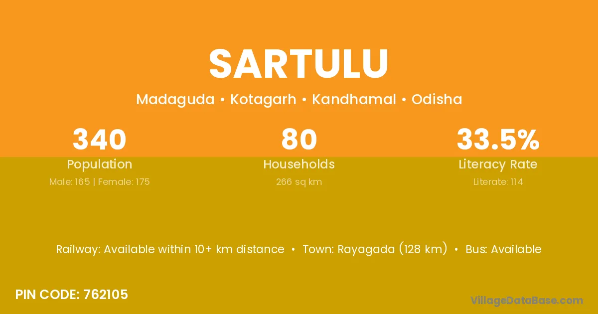
Sartulu village is located in the Kotagarh Tehsil of the Kandhamal district in Odisha .
Block / Tehsil → Kotagarh
District → Kandhamal
State → Odisha
According to Census 2011 information, the village code of Sartulu village is 762105.
Sartulu village has a total population of 340 people, of which 165 are males and 175 are females.
The literacy rate of Sartulu village is 33.53%. Male literacy stands at 44.85% and female literacy at 22.86%.
There are approximately 80 households in Sartulu village.
Rayagada (128 km) is the nearest town to Sartulu village for major economic activities and is located approximately 128 km away.
The population of Sartulu village is distributed between literate and illiterate residents as follows:
| Particulars | Male | Female | Total |
|---|---|---|---|
| Literate | 74 | 40 | 114 |
| Illiterate | 91 | 135 | 226 |
| Total | 165 | 175 | 340 |
Source: Census 2011
| Village | District |
|---|---|
| Adipadar | Baudh |
| Adipadar | Kandhamal |
| Adipadar | Kandhamal |
| Dedrakaju | Kandhamal |
| Gahiguda Jangal | Kandhamal |
| Kesariguda | Gajapati |
| Kesariguda | Kandhamal |
| Kesariguda | Koraput |
| Kesariguda | Nabarangapur |
| Kotagada | Kandhamal |
| Kotagada | Nayagarh |
| Madangi | Kandhamal |
| Rada | Hamirpur |
| Rada | Samba |
| Rada | Anugul |
| Rada | Kandhamal |
| Rada | Sirohi |
| Rada | Azamgarh |
| Ranipanga | Kandhamal |
| Supamaha | Kandhamal |
| Uparmadhuguda | Kandhamal |
| Usurumaha | Kandhamal |
No reviews yet. Be the first to review this village!
Available within 10+ km distance
Available within 10+ km distance
Available within 10+ km distance