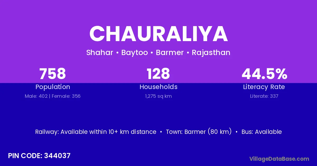
Chauraliya village is located in the Baytoo Tehsil of the Barmer district in Rajasthan .
Block / Tehsil → Baytoo
District → Barmer
State → Rajasthan
According to Census 2011 information, the village code of Chauraliya village is 344037.
Chauraliya village has a total population of 758 people, of which 402 are males and 356 are females.
The literacy rate of Chauraliya village is 44.46%. Male literacy stands at 53.48% and female literacy at 34.27%.
There are approximately 128 households in Chauraliya village.
Barmer (80 km) is the nearest town to Chauraliya village for major economic activities and is located approximately 80 km away.
The population of Chauraliya village is distributed between literate and illiterate residents as follows:
| Particulars | Male | Female | Total |
|---|---|---|---|
| Literate | 215 | 122 | 337 |
| Illiterate | 187 | 234 | 421 |
| Total | 402 | 356 | 758 |
Source: Census 2011
| Village | District |
|---|---|
| Deeponiyon Ki Dhani | Barmer |
| Gogaji Ka Mandir | Barmer |
| Janduo Ki Dhani | Barmer |
| Jhak | Barmer |
| Jhak | Jalor |
| Jhak | Jodhpur |
| Kheenpar | Barmer |
| Khetarlai | Barmer |
| Phatoombiya Nadi | Barmer |
| Ramsariya | Barmer |
| Ridhusar | Barmer |
| Sahar | Aurangabad |
| Sahar | Bhojpur |
| Sahar | Madhubani |
| Sahar | Jammu |
| Sahar | Barmer |
| Sahar | Bulandshahr |
| Sahar | Mathura |
| Ugreniyon Ki Dhani | Barmer |
No reviews yet. Be the first to review this village!
Available within 10+ km distance
Available within 5 - 10 km distance
Available within 5 - 10 km distance