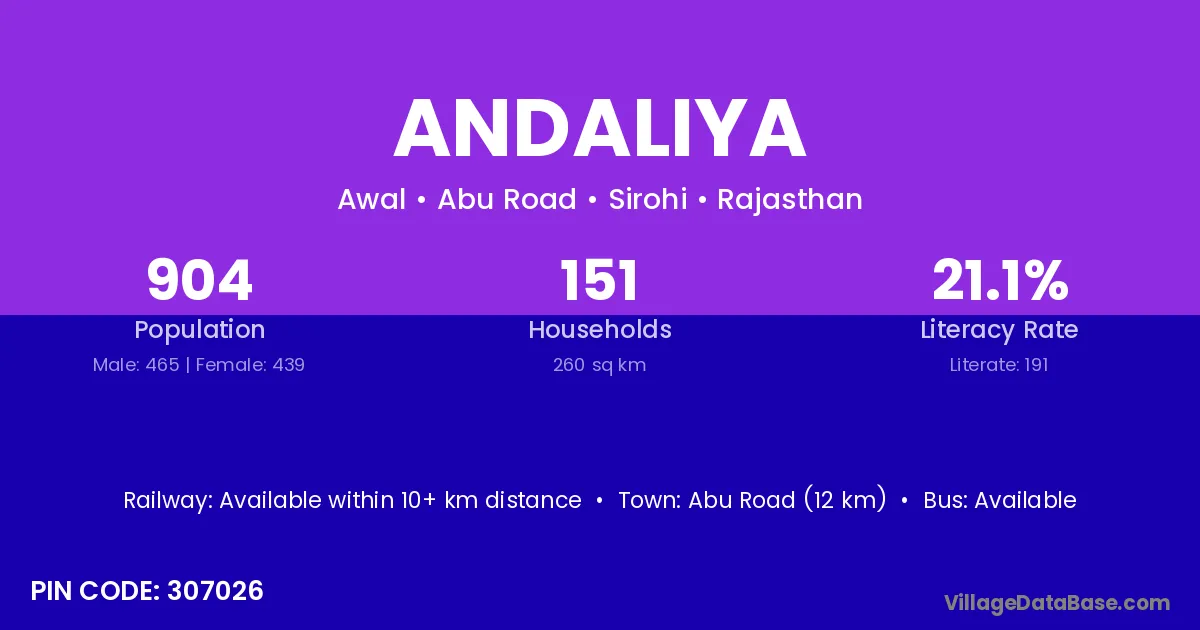
Andaliya village is located in the Abu Road Tehsil of the Sirohi district in Rajasthan .
Block / Tehsil → Abu Road
District → Sirohi
State → Rajasthan
According to Census 2011 information, the village code of Andaliya village is 307026.
Andaliya village has a total population of 904 people, of which 465 are males and 439 are females.
The literacy rate of Andaliya village is 21.13%. Male literacy stands at 33.98% and female literacy at 7.52%.
There are approximately 151 households in Andaliya village.
Abu Road (12 km) is the nearest town to Andaliya village for major economic activities and is located approximately 12 km away.
The population of Andaliya village is distributed between literate and illiterate residents as follows:
| Particulars | Male | Female | Total |
|---|---|---|---|
| Literate | 158 | 33 | 191 |
| Illiterate | 307 | 406 | 713 |
| Total | 465 | 439 | 904 |
Source: Census 2011
| Village | District |
|---|---|
| Awal | Banas Kantha |
| Awal | Sirohi |
| Chanar | Uttar Bastar Kanker |
| Chanar | Sirohi |
| Chotila | Pali |
| Chotila | Sirohi |
| Duna Kakar | Sirohi |
| Forest Chotila | Sirohi |
| Girwar | Bilaspur |
| Girwar | Sagar |
| Girwar | Shajapur |
| Girwar | Pali |
| Girwar | Sirohi |
| Kyariya | Panch Mahals |
| Kyariya | Sirohi |
| Kyariya | Tonk |
| Kyariya | Udaipur |
| Mahi Khera | Sirohi |
| Meergarh | Sirohi |
| Redwa Kalan | Sirohi |
| Redwa Khurd | Sirohi |
No reviews yet. Be the first to review this village!
Available within 10+ km distance
Available within 10+ km distance
Available within 10+ km distance