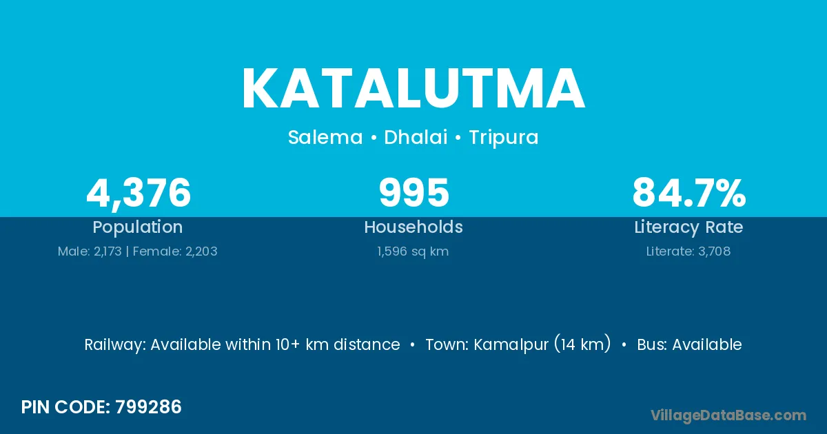
Katalutma village is located in the Salema Subdivision of the Dhalai district in Tripura .
Block / Subdivision → Salema
District → Dhalai
State → Tripura
According to Census 2011 information, the village code of Katalutma village is 799286.
Katalutma village has a total population of 4,376 people, of which 2,173 are males and 2,203 are females.
The literacy rate of Katalutma village is 84.73%. Male literacy stands at 86.38% and female literacy at 83.11%.
There are approximately 995 households in Katalutma village.
Kamalpur (14 km) is the nearest town to Katalutma village for major economic activities and is located approximately 14 km away.
The population of Katalutma village is distributed between literate and illiterate residents as follows:
| Particulars | Male | Female | Total |
|---|---|---|---|
| Literate | 1,877 | 1,831 | 3,708 |
| Illiterate | 296 | 372 | 668 |
| Total | 2,173 | 2,203 | 4,376 |
Source: Census 2011
| Village | District |
|---|---|
| Abhanga | Dhalai |
| Apareshkar | Dhalai |
| Baralutma | Dhalai |
| Debichhara | Dhalai |
| Jamthumbari | Dhalai |
| Maharani | Purba Champaran |
| Maharani | Dhalai |
| Maharani | Ballia |
| Maharani | Kushinagar |
| Maharani | Maldah |
| Maharani | Maldah |
| Mendi | Bundi |
| Mendi | Dausa |
| Mendi | Dhalai |
| Michhuria | Dhalai |
| Nakful | Dhalai |
| Nakful | North Twenty Four Parganas |
| Nakful | North Twenty Four Parganas |
| Panbua | Dhalai |
| Simbuchak | Dhalai |
No reviews yet. Be the first to review this village!
Available within 10+ km distance
Available within village
Available within village