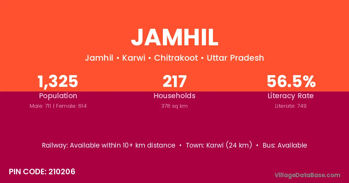
Jamhil village is located in the Karwi Tehsil of the Chitrakoot district in Uttar Pradesh .
Block / Tehsil → Karwi
District → Chitrakoot
State → Uttar Pradesh
According to Census 2011 information, the village code of Jamhil village is 210206.
Jamhil village has a total population of 1,325 people, of which 711 are males and 614 are females.
The literacy rate of Jamhil village is 56.53%. Male literacy stands at 68.21% and female literacy at 43.00%.
There are approximately 217 households in Jamhil village.
Karwi (24 km) is the nearest town to Jamhil village for major economic activities and is located approximately 24 km away.
The population of Jamhil village is distributed between literate and illiterate residents as follows:
| Particulars | Male | Female | Total |
|---|---|---|---|
| Literate | 485 | 264 | 749 |
| Illiterate | 226 | 350 | 576 |
| Total | 711 | 614 | 1,325 |
Source: Census 2011
| Village | District |
|---|---|
| Bachharan | Chitrakoot |
| Gaura Coni | Chitrakoot |
| Lohada | Gulbarga |
| Lohada | Singrauli |
| Lohada | Chitrakoot |
| Lohada | Sonbhadra |
| Nonar | Aurangabad |
| Nonar | Bhojpur |
| Nonar | Kaimur |
| Nonar | Chandauli |
| Nonar | Chitrakoot |
| Nonar | Mirzapur |
| Panauti | Chitrakoot |
| Parsiddpur | Chitrakoot |
| Pathara Mani | Chitrakoot |
| Piprondar | Chitrakoot |
| Ram Puriya Sani | Chitrakoot |
| Sagawara | Chitrakoot |
| Saligpur | Chitrakoot |
No reviews yet. Be the first to review this village!
Available within 10+ km distance
Available within village
Available within 10+ km distance