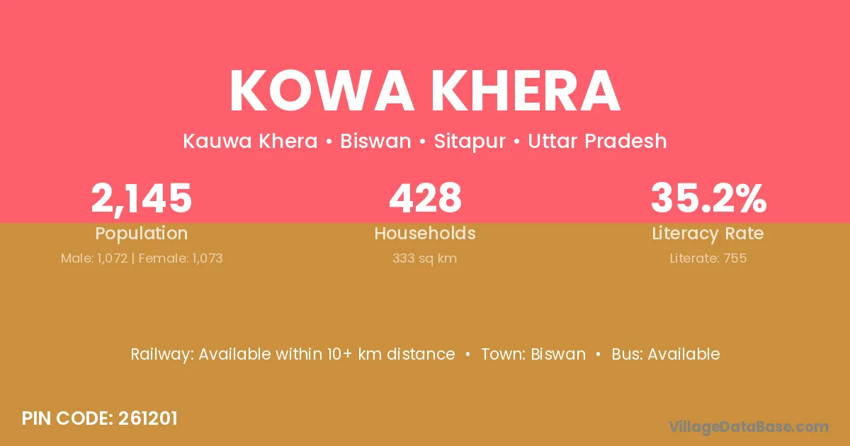
Kowa Khera village is located in the Biswan Tehsil of the Sitapur district in Uttar Pradesh .
Block / Tehsil → Biswan
District → Sitapur
State → Uttar Pradesh
According to Census 2011 information, the village code of Kowa Khera village is 261201.
Kowa Khera village has a total population of 2,145 people, of which 1,072 are males and 1,073 are females.
The literacy rate of Kowa Khera village is 35.20%. Male literacy stands at 43.75% and female literacy at 26.65%.
There are approximately 428 households in Kowa Khera village.
Biswan is the nearest town to Kowa Khera village for major economic activities
The population of Kowa Khera village is distributed between literate and illiterate residents as follows:
| Particulars | Male | Female | Total |
|---|---|---|---|
| Literate | 469 | 286 | 755 |
| Illiterate | 603 | 787 | 1,390 |
| Total | 1,072 | 1,073 | 2,145 |
Source: Census 2011
| Village | District |
|---|---|
| Bagha Dhack | Sitapur |
| Baghaia | Sitapur |
| Bara Singha | Sitapur |
| Hanthia Gajipur | Sitapur |
| Kamahria | Sitapur |
| Madar Mau | Sitapur |
| Pach Dewara | Sitapur |
| Qazi Sarayan | Sitapur |
| Shekhvapur | Hardoi |
| Shekhvapur | Sitapur |
| Tenduwa | Darbhanga |
| Tenduwa | Rohtas |
| Tenduwa | Bilaspur |
| Tenduwa | Bilaspur |
| Tenduwa | Durg |
| Tenduwa | Durg |
| Tenduwa | Janjgir Champa |
| Tenduwa | Koriya |
| Tenduwa | Raigarh |
| Tenduwa | Raipur |
| Tenduwa | Garhwa |
| Tenduwa | Azamgarh |
| Tenduwa | Ballia |
| Tenduwa | Balrampur |
| Tenduwa | Basti |
| Tenduwa | Jaunpur |
| Tenduwa | Jhansi |
| Tenduwa | Kheri |
| Tenduwa | Shrawasti |
| Tenduwa | Sitapur |
| Tenduwa | Sitapur |
| Tenduwa | Sultanpur |
| Zamoura | Sitapur |
No reviews yet. Be the first to review this village!
Available within 10+ km distance
Available within 10+ km distance
Available within 10+ km distance