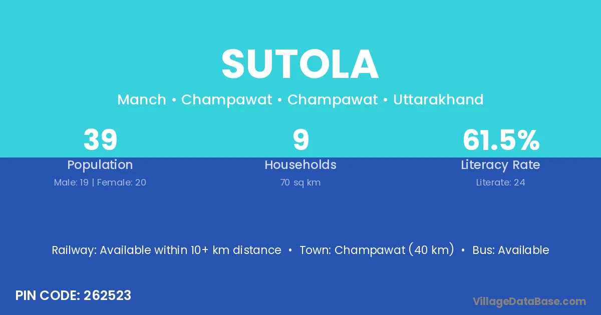
Sutola village is located in the Champawat Tehsil of the Champawat district in Uttarakhand .
Block / Tehsil → Champawat
District → Champawat
State → Uttarakhand
According to Census 2011 information, the village code of Sutola village is 262523.
Sutola village has a total population of 39 people, of which 19 are males and 20 are females.
The literacy rate of Sutola village is 61.54%. Male literacy stands at 78.95% and female literacy at 45.00%.
There are approximately 9 households in Sutola village.
Champawat (40 km) is the nearest town to Sutola village for major economic activities and is located approximately 40 km away.
The population of Sutola village is distributed between literate and illiterate residents as follows:
| Particulars | Male | Female | Total |
|---|---|---|---|
| Literate | 15 | 9 | 24 |
| Illiterate | 4 | 11 | 15 |
| Total | 19 | 20 | 39 |
Source: Census 2011
| Village | District |
|---|---|
| Aam Khola | Champawat |
| Bachkot | Champawat |
| Bachkot | Pithoragarh |
| Gawani | Chamoli |
| Gawani | Champawat |
| Kaari | Champawat |
| Khar Giri | Champawat |
| Kukrauni | Champawat |
| Mankanda | Champawat |
| Naag | Champawat |
| Polap | Champawat |
| Ruiya | Kaimur |
| Ruiya | Hardoi |
| Ruiya | Champawat |
| Ruiya | North Twenty Four Parganas |
| Ruiya | North Twenty Four Parganas |
| Tamli | Godda |
| Tamli | Sahibganj |
| Tamli | Champawat |
No reviews yet. Be the first to review this village!
Available within 10+ km distance
Available within 10+ km distance
Available within 10+ km distance