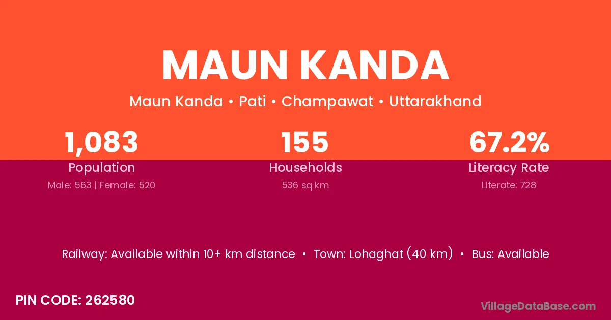
Maun Kanda village is located in the Pati Tehsil of the Champawat district in Uttarakhand .
Block / Tehsil → Pati
District → Champawat
State → Uttarakhand
According to Census 2011 information, the village code of Maun Kanda village is 262580.
Maun Kanda village has a total population of 1,083 people, of which 563 are males and 520 are females.
The literacy rate of Maun Kanda village is 67.22%. Male literacy stands at 79.75% and female literacy at 53.65%.
There are approximately 155 households in Maun Kanda village.
Lohaghat (40 km) is the nearest town to Maun Kanda village for major economic activities and is located approximately 40 km away.
The population of Maun Kanda village is distributed between literate and illiterate residents as follows:
| Particulars | Male | Female | Total |
|---|---|---|---|
| Literate | 449 | 279 | 728 |
| Illiterate | 114 | 241 | 355 |
| Total | 563 | 520 | 1,083 |
Source: Census 2011
| Village | District |
|---|---|
| Baligaon | Darrang |
| Baligaon | Dhemaji |
| Baligaon | Lakhimpur |
| Baligaon | Udalguri |
| Baligaon | Udalguri |
| Baligaon | Bhojpur |
| Baligaon | Champawat |
| Baligaon | Pithoragarh |
| Bham Lagga Mulakot | Champawat |
| Chaurakot | Reasi |
| Chaurakot | Champawat |
| Dashiya | Champawat |
| Ejatta Hungra | Champawat |
| Golana Seri | Champawat |
| Haldua Khark | Champawat |
| Kandey | Lohit |
| Kandey | Champawat |
| Patangaon | Champawat |
| Sundungra | Champawat |
| Thuwa Mauni | Champawat |
No reviews yet. Be the first to review this village!
Available within 10+ km distance
Available within 10+ km distance
Available within <5 km distance