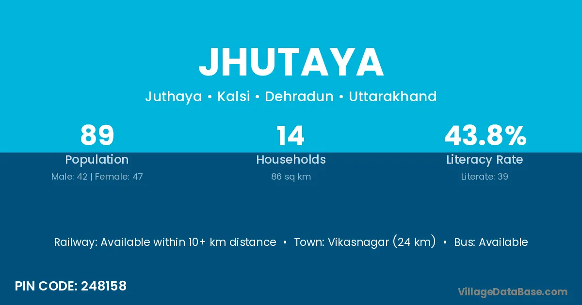
Jhutaya village is located in the Kalsi Tehsil of the Dehradun district in Uttarakhand .
Block / Tehsil → Kalsi
District → Dehradun
State → Uttarakhand
According to Census 2011 information, the village code of Jhutaya village is 248158.
Jhutaya village has a total population of 89 people, of which 42 are males and 47 are females.
The literacy rate of Jhutaya village is 43.82%. Male literacy stands at 50.00% and female literacy at 38.30%.
There are approximately 14 households in Jhutaya village.
Vikasnagar (24 km) is the nearest town to Jhutaya village for major economic activities and is located approximately 24 km away.
The population of Jhutaya village is distributed between literate and illiterate residents as follows:
| Particulars | Male | Female | Total |
|---|---|---|---|
| Literate | 21 | 18 | 39 |
| Illiterate | 21 | 29 | 50 |
| Total | 42 | 47 | 89 |
Source: Census 2011
| Village | District |
|---|---|
| Amraha | Gaya |
| Amraha | Kaimur |
| Amraha | Shahdol |
| Amraha | Gorakhpur |
| Amraha | Dehradun |
| Badhana | Jind |
| Badhana | Sirmaur |
| Badhana | Baleshwar |
| Badhana | Hoshiarpur |
| Badhana | Dehradun |
| Chapanu | Dehradun |
| Dadhau | Dehradun |
| Dhoira | Dehradun |
| Kaha Nehra Punagh | Dehradun |
| Khatar | Dehradun |
| Kuitha | Dehradun |
| Sairi | Bilaspur |
| Sairi | Solan |
| Sairi | Solan |
| Sairi | Puri |
| Sairi | Dehradun |
| Semaha | Datia |
| Semaha | Dehradun |
| Thaina | Dehradun |
No reviews yet. Be the first to review this village!
Available within 10+ km distance
Available within 10+ km distance
Available within 10+ km distance