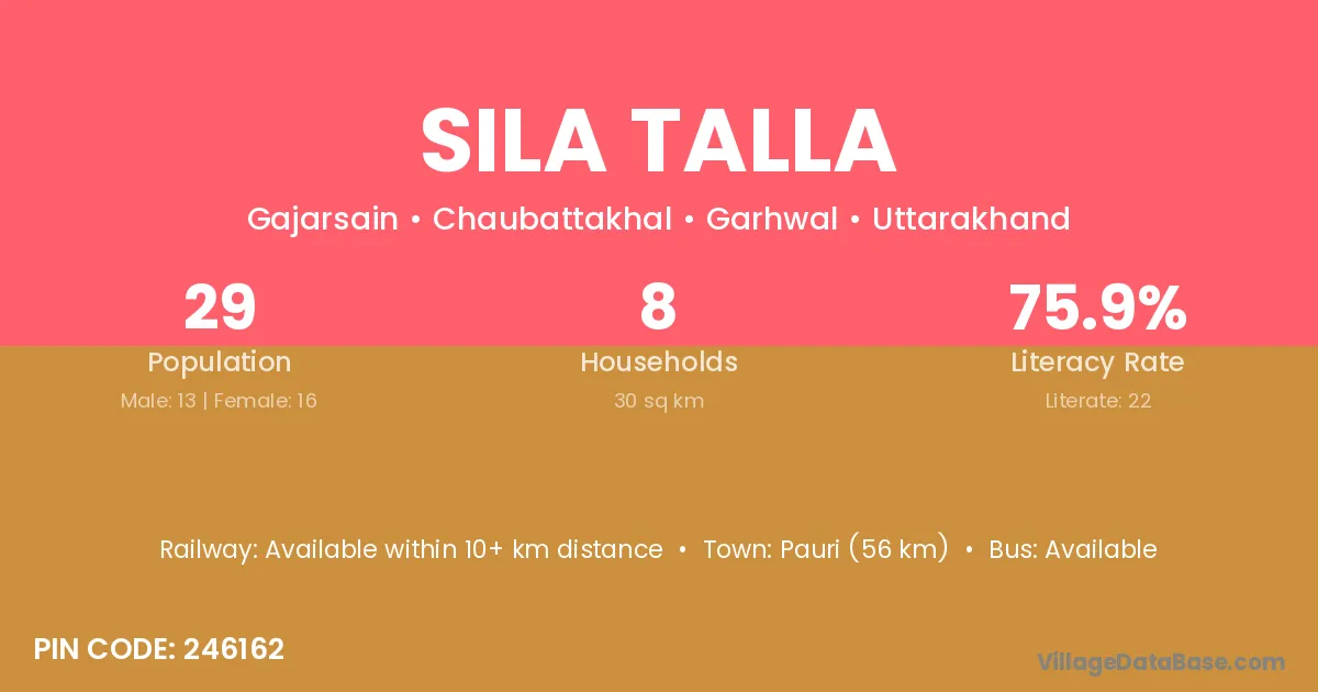
Sila Talla village is located in the Chaubattakhal Tehsil of the Garhwal district in Uttarakhand .
Block / Tehsil → Chaubattakhal
District → Garhwal
State → Uttarakhand
According to Census 2011 information, the village code of Sila Talla village is 246162.
Sila Talla village has a total population of 29 people, of which 13 are males and 16 are females.
The literacy rate of Sila Talla village is 75.86%. Male literacy stands at 92.31% and female literacy at 62.50%.
There are approximately 8 households in Sila Talla village.
Pauri (56 km) is the nearest town to Sila Talla village for major economic activities and is located approximately 56 km away.
The population of Sila Talla village is distributed between literate and illiterate residents as follows:
| Particulars | Male | Female | Total |
|---|---|---|---|
| Literate | 12 | 10 | 22 |
| Illiterate | 1 | 6 | 7 |
| Total | 13 | 16 | 29 |
Source: Census 2011
| Village | District |
|---|---|
| Gajarsain | Garhwal |
| Ghidiyali | Garhwal |
| Jadiyani | Garhwal |
| Kachhkatta | Garhwal |
| Kaphara | Garhwal |
| Kathur Urf Dharam Pur | Garhwal |
| Mathana | Kurukshetra |
| Mathana | Alirajpur |
| Mathana | Ashoknagar |
| Mathana | Shivpuri |
| Mathana | Baran |
| Mathana | Jyotiba Phule Nagar |
| Mathana | Mirzapur |
| Mathana | Moradabad |
| Mathana | Moradabad |
| Mathana | Saharanpur |
| Mathana | Shahjahanpur |
| Mathana | Sitapur |
| Mathana | Garhwal |
| Mathchauri | Garhwal |
| Nau Gaon Pathar | Garhwal |
| Paniya | Lower Subansiri |
| Paniya | Amreli |
| Paniya | Amreli |
| Paniya | Dohad |
| Paniya | Panch Mahals |
| Paniya | Rajgarh |
| Paniya | Rajsamand |
| Paniya | Garhwal |
| Panthar | Garhwal |
No reviews yet. Be the first to review this village!
Available within 10+ km distance
Available within <5 km distance
Available within 5 - 10 km distance