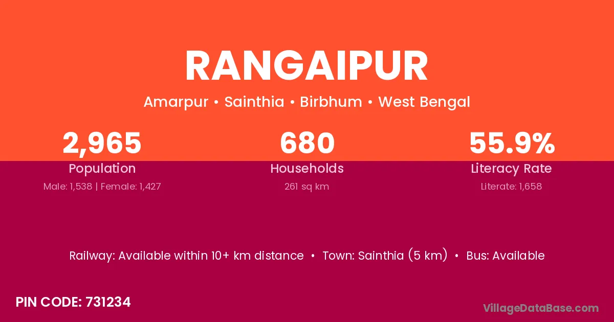
Rangaipur village is located in the Sainthia Subdivision of the Birbhum district in West Bengal .
Block / Subdivision → Sainthia
District → Birbhum
State → West Bengal
According to Census 2011 information, the village code of Rangaipur village is 731234.
Rangaipur village has a total population of 2,965 people, of which 1,538 are males and 1,427 are females.
The literacy rate of Rangaipur village is 55.92%. Male literacy stands at 59.49% and female literacy at 52.07%.
There are approximately 680 households in Rangaipur village.
Sainthia (5 km) is the nearest town to Rangaipur village for major economic activities and is located approximately 5 km away.
The population of Rangaipur village is distributed between literate and illiterate residents as follows:
| Particulars | Male | Female | Total |
|---|---|---|---|
| Literate | 915 | 743 | 1,658 |
| Illiterate | 623 | 684 | 1,307 |
| Total | 1,538 | 1,427 | 2,965 |
Source: Census 2011
| Village | District |
|---|---|
| Bengra | Pashchim Champaran |
| Bengra | Birbhum |
| Bhalian | Rupnagar |
| Bhalian | Birbhum |
| Bhalian | Birbhum |
| Bijuri | Satna |
| Bijuri | Shahdol |
| Bijuri | Banda |
| Bijuri | Mirzapur |
| Bijuri | Birbhum |
| Chhautara | Birbhum |
| Ganutia | Birbhum |
| Ganutia | Birbhum |
| Harishkopa | Birbhum |
| Khamartora | Birbhum |
| Kunuri | Birbhum |
| Mahishdahari | Birbhum |
| Matpalsha | Birbhum |
| Parishar | Birbhum |
No reviews yet. Be the first to review this village!
Available within 10+ km distance
Available within 5 - 10 km distance
Available within village