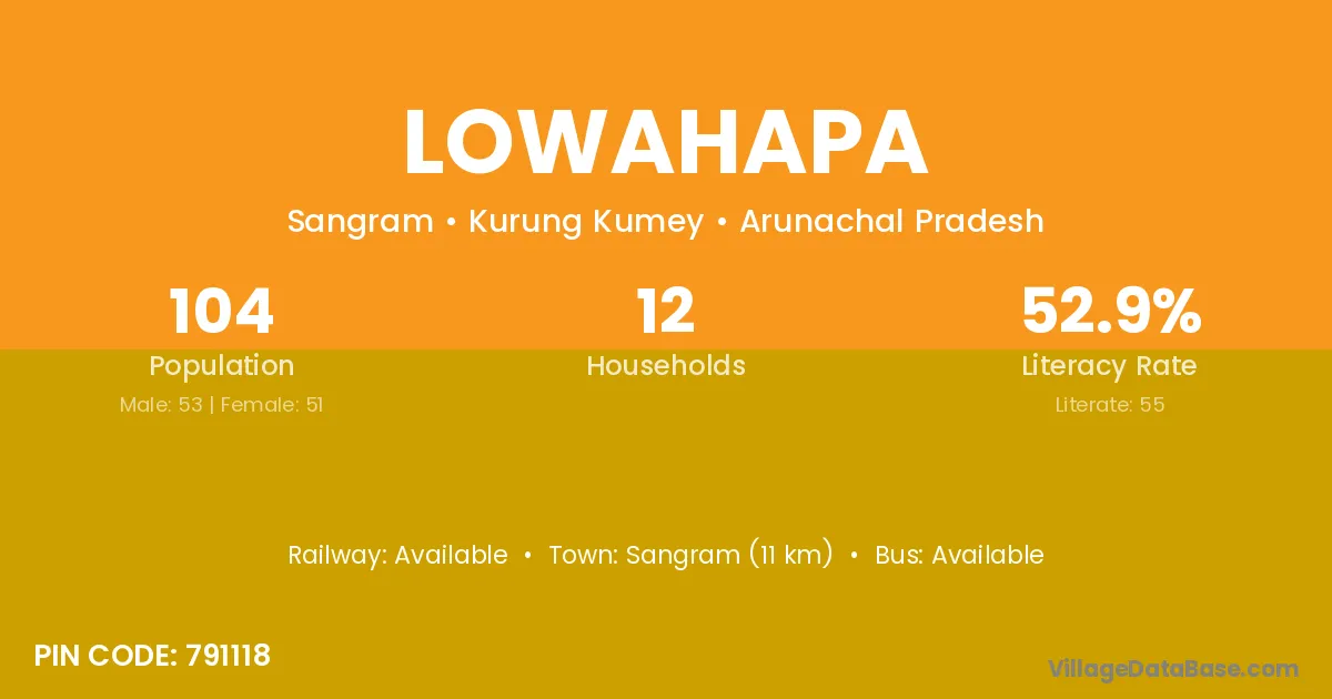
Lowahapa village is located in the Sangram Circle of the Kurung Kumey district in Arunachal Pradesh .
Block / Circle → Sangram
District → Kurung Kumey
State → Arunachal Pradesh
According to Census 2011 information, the village code of Lowahapa village is 791118.
Lowahapa village has a total population of 104 people, of which 53 are males and 51 are females.
The literacy rate of Lowahapa village is 52.88%. Male literacy stands at 58.49% and female literacy at 47.06%.
There are approximately 12 households in Lowahapa village.
Sangram (11 km) is the nearest town to Lowahapa village for major economic activities and is located approximately 11 km away.
The population of Lowahapa village is distributed between literate and illiterate residents as follows:
| Particulars | Male | Female | Total |
|---|---|---|---|
| Literate | 31 | 24 | 55 |
| Illiterate | 22 | 27 | 49 |
| Total | 53 | 51 | 104 |
Source: Census 2011
| Village | District |
|---|---|
| Dokum Coloney | Kurung Kumey |
| Kamcho Koyor | Kurung Kumey |
| Kamrung | East Kameng |
| Kamrung | Kurung Kumey |
| Kamrung | Papum Pare |
| Leel Camp | Kurung Kumey |
| Napah | Kurung Kumey |
| Powak Korar | Kurung Kumey |
| Raikpobe | Kurung Kumey |
| Sangram H Q | Kurung Kumey |
| Sona | Kurung Kumey |
| Sona | Patna |
| Sona | Ashoknagar |
| Sona | Vidisha |
| Sona | Shahid Bhagat Singh Nagar |
| Sona | Bareilly |
| Sona | Etah |
| Sona | Ghazipur |
| Sona | Kanpur Nagar |
| Sona | Meerut |
| Sona | Rampur |
| Sona | Saharanpur |
| Tachak | Kurung Kumey |
| Takapop | Kurung Kumey |
No reviews yet. Be the first to review this village!
Available
Available
Available