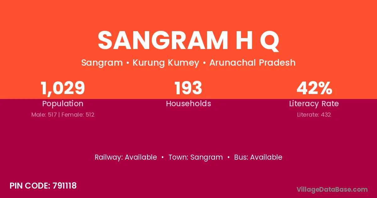
Sangram H Q village is located in the Sangram Circle of the Kurung Kumey district in Arunachal Pradesh .
Block / Circle → Sangram
District → Kurung Kumey
State → Arunachal Pradesh
According to Census 2011 information, the village code of Sangram H Q village is 791118.
Sangram H Q village has a total population of 1,029 people, of which 517 are males and 512 are females.
The literacy rate of Sangram H Q village is 41.98%. Male literacy stands at 44.87% and female literacy at 39.06%.
There are approximately 193 households in Sangram H Q village.
Sangram is the nearest town to Sangram H Q village for major economic activities
The population of Sangram H Q village is distributed between literate and illiterate residents as follows:
| Particulars | Male | Female | Total |
|---|---|---|---|
| Literate | 232 | 200 | 432 |
| Illiterate | 285 | 312 | 597 |
| Total | 517 | 512 | 1,029 |
Source: Census 2011
| Village | District |
|---|---|
| Dokum Coloney | Kurung Kumey |
| Kamrung | East Kameng |
| Kamrung | Kurung Kumey |
| Kamrung | Papum Pare |
| Leel Camp | Kurung Kumey |
| Lowahapa | Kurung Kumey |
| Napah | Kurung Kumey |
| Powak Korar | Kurung Kumey |
| Raikpobe | Kurung Kumey |
| Sangme | Kurung Kumey |
| Sona | Kurung Kumey |
| Sona | Patna |
| Sona | Ashoknagar |
| Sona | Vidisha |
| Sona | Shahid Bhagat Singh Nagar |
| Sona | Bareilly |
| Sona | Etah |
| Sona | Ghazipur |
| Sona | Kanpur Nagar |
| Sona | Meerut |
| Sona | Rampur |
| Sona | Saharanpur |
| Tachak | Kurung Kumey |
| Takapop | Kurung Kumey |
No reviews yet. Be the first to review this village!
Available
Available
Available