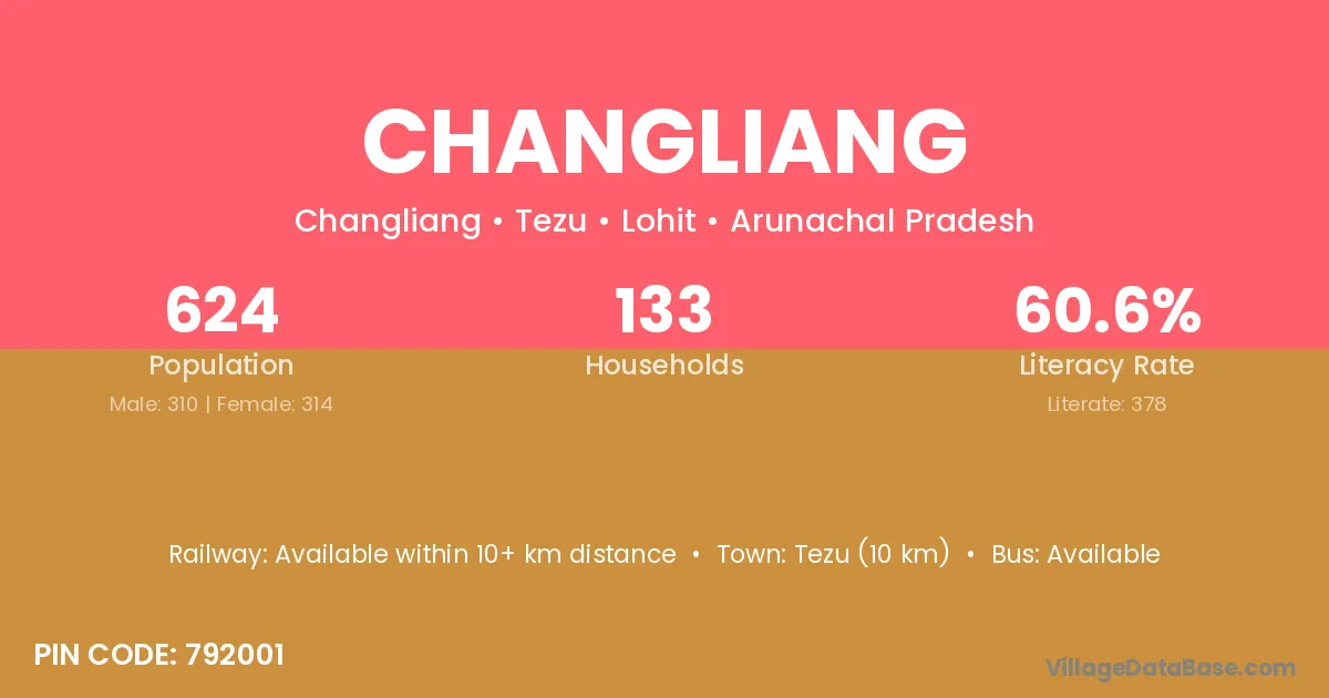
Changliang village is located in the Tezu Circle of the Lohit district in Arunachal Pradesh .
Block / Circle → Tezu
District → Lohit
State → Arunachal Pradesh
According to Census 2011 information, the village code of Changliang village is 792001.
Changliang village has a total population of 624 people, of which 310 are males and 314 are females.
The literacy rate of Changliang village is 60.58%. Male literacy stands at 66.13% and female literacy at 55.10%.
There are approximately 133 households in Changliang village.
Tezu (10 km) is the nearest town to Changliang village for major economic activities and is located approximately 10 km away.
The population of Changliang village is distributed between literate and illiterate residents as follows:
| Particulars | Male | Female | Total |
|---|---|---|---|
| Literate | 205 | 173 | 378 |
| Illiterate | 105 | 141 | 246 |
| Total | 310 | 314 | 624 |
Source: Census 2011
| Village | District |
|---|---|
| Chetangum | Lohit |
| Demwe | Lohit |
| Duraliang | Lohit |
| Duranallah Hydel Point | Lohit |
| Jeinko | Lohit |
| Khorabah | Lohit |
| Panbari | Lohit |
| Panbari | Baksa |
| Panbari | Baksa |
| Panbari | Chirang |
| Panbari | Dhemaji |
| Panbari | Golaghat |
| Panbari | Golaghat |
| Panbari | Kamrup |
| Panbari | Karbi Anglong |
| Panbari | Lakhimpur |
| Panbari | Nalbari |
| Panbari | Nalbari |
| Panbari | Sonitpur |
| Panbari | Nandurbar |
| Panbari | East Garo Hills |
| Panbari | West Garo Hills |
| Panbari | Jalpaiguri |
| Panbari | Jalpaiguri |
| Parasuram Cement Plant | Lohit |
| Tafra Gam | Lohit |
| Tezu Gam | Lohit |
| Tidding | Lohit |
No reviews yet. Be the first to review this village!
Available within 10+ km distance
Available within 5 - 10 km distance
Available within 5 - 10 km distance