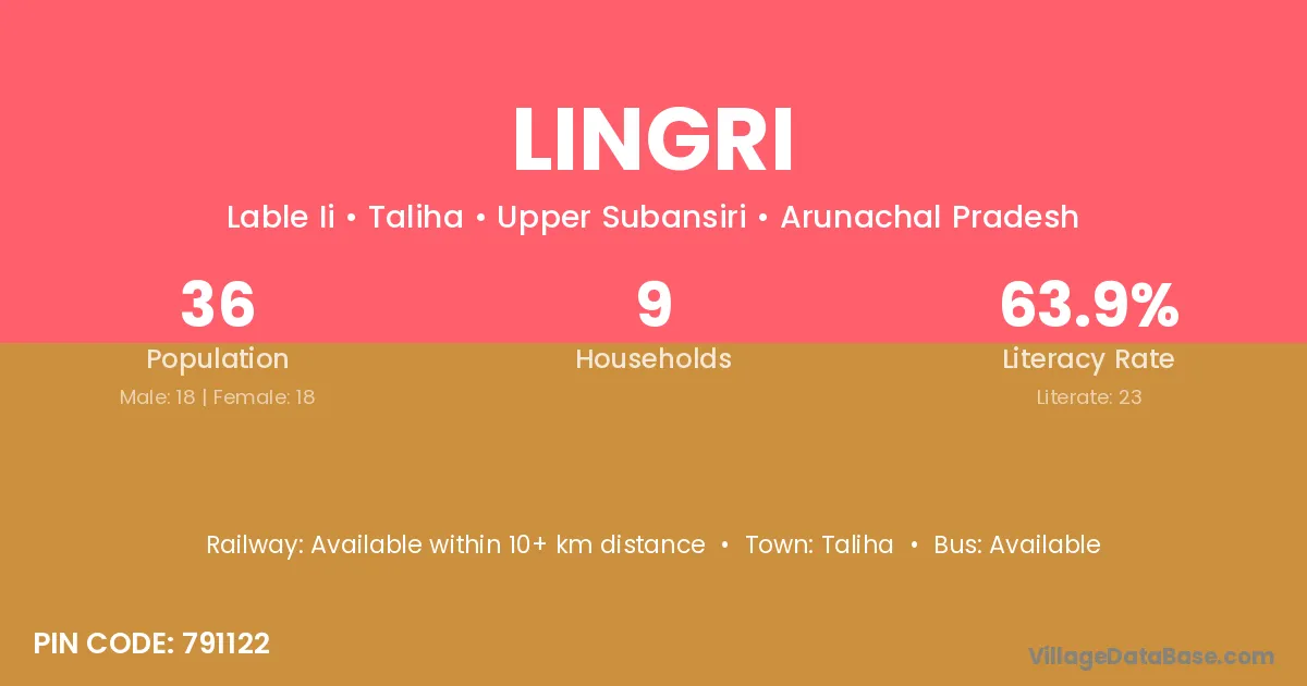
Lingri village is located in the Taliha Circle of the Upper Subansiri district in Arunachal Pradesh .
Block / Circle → Taliha
District → Upper Subansiri
State → Arunachal Pradesh
According to Census 2011 information, the village code of Lingri village is 791122.
Lingri village has a total population of 36 people, of which 18 are males and 18 are females.
The literacy rate of Lingri village is 63.89%. Male literacy stands at 72.22% and female literacy at 55.56%.
There are approximately 9 households in Lingri village.
Taliha is the nearest town to Lingri village for major economic activities
The population of Lingri village is distributed between literate and illiterate residents as follows:
| Particulars | Male | Female | Total |
|---|---|---|---|
| Literate | 13 | 10 | 23 |
| Illiterate | 5 | 8 | 13 |
| Total | 18 | 18 | 36 |
Source: Census 2011
| Village | District |
|---|---|
| Arma | Upper Subansiri |
| Arma | Lakhisarai |
| Arma | Ranchi |
| Arma | Kandhamal |
| Arma | Paschim Medinipur |
| Arma | Paschim Medinipur |
| Bomdom | Upper Subansiri |
| Haning | Upper Subansiri |
| Jami | Vizianagaram |
| Jami | Upper Subansiri |
| Jami | Balaghat |
| Jami | Rajgarh |
| Jami | Gajapati |
| Kaji | Upper Subansiri |
| Kaji | Jhunjhunun |
| Kamlo | Upper Subansiri |
| Kamlo | Satna |
| Lable Moring | Upper Subansiri |
| Lower Ngaba | Upper Subansiri |
| Nimpu | Upper Subansiri |
| Pillingmaling | Upper Subansiri |
| Yangampu | Upper Subansiri |
No reviews yet. Be the first to review this village!
Available within 10+ km distance
Available within 10+ km distance
Available within 10+ km distance