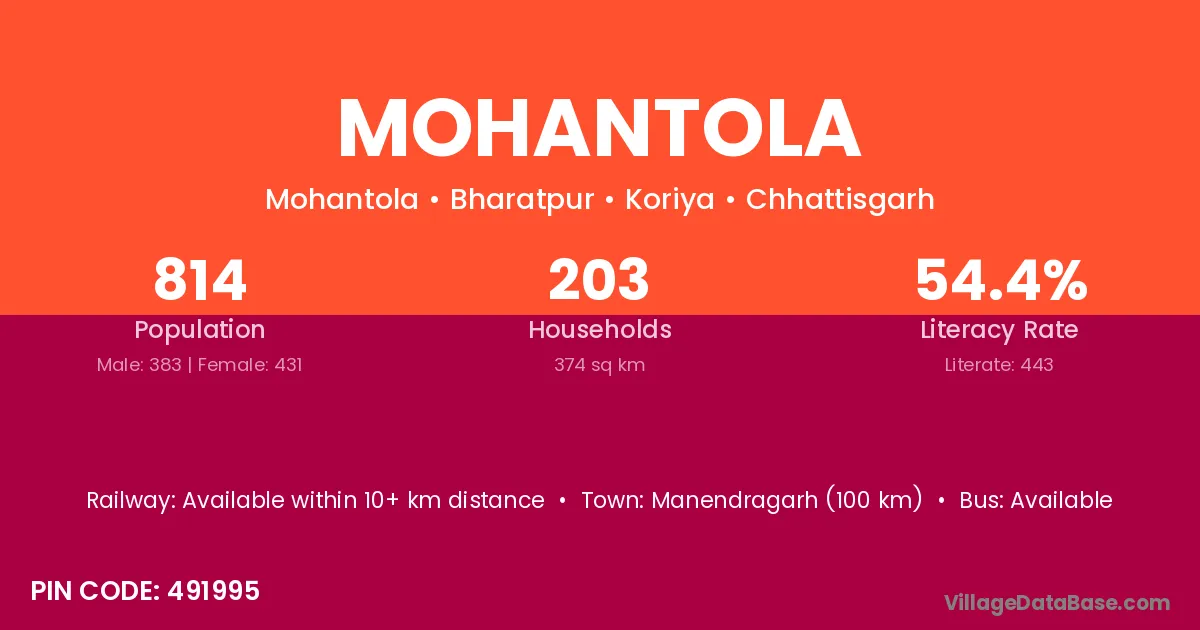
Mohantola village is located in the Bharatpur Tehsil of the Koriya district in Chhattisgarh .
Block / Tehsil → Bharatpur
District → Koriya
State → Chhattisgarh
According to Census 2011 information, the village code of Mohantola village is 491995.
Mohantola village has a total population of 814 people, of which 383 are males and 431 are females.
The literacy rate of Mohantola village is 54.42%. Male literacy stands at 65.80% and female literacy at 44.32%.
There are approximately 203 households in Mohantola village.
Manendragarh (100 km) is the nearest town to Mohantola village for major economic activities and is located approximately 100 km away.
The population of Mohantola village is distributed between literate and illiterate residents as follows:
| Particulars | Male | Female | Total |
|---|---|---|---|
| Literate | 252 | 191 | 443 |
| Illiterate | 131 | 240 | 371 |
| Total | 383 | 431 | 814 |
Source: Census 2011
| Village | District |
|---|---|
| Bahrasi | Koriya |
| Benipura | Koriya |
| Benipura | Gwalior |
| Benipura | Sheopur |
| Harri | Madhubani |
| Harri | Sitamarhi |
| Harri | Bilaspur |
| Harri | Jashpur |
| Harri | Koriya |
| Harri | Surguja |
| Harri | Gumla |
| Harri | Anuppur |
| Harri | Anuppur |
| Harri | Shahdol |
| Harri | Shahdol |
| Harri | Chitrakoot |
| Harri | Hardoi |
| Karimati | Kabeerdham |
| Karimati | Korba |
| Karimati | Koriya |
| Karimati | Surguja |
| Karimati | Hazaribagh |
| Karimati | Hazaribagh |
| Karimati | Simdega |
| Karimati | Satna |
| Karimati | Sidhi |
| Karimati | Sidhi |
| Karimati | Umaria |
| Karimati | Sundargarh |
| Kashitola | Koriya |
| Kashitola | Rajnandgaon |
| Khandakhoh | Koriya |
| Khetauli | Koriya |
| Khetauli | Shahdol |
| Khetauli | Hardoi |
| Lakhantola | Koriya |
| Pichhaura Bandh | Koriya |
| Tikaritola | Koriya |
| Umarwah | Koriya |
No reviews yet. Be the first to review this village!
Available within 10+ km distance
Available
Available within <5 km distance